Install the app
How to install the app on iOS

Follow along with the video below to see how to install our site as a web app on your home screen.

Note: This feature may not be available in some browsers.

  • Don't miss out on all the fun! Register on our forums to post and have added features! Membership levels include a FREE membership tier.

Island Park Snow conditions 07/08

I have a wedding reception and tickets to a little "open house" in Rexburg to attend on Friday night and was planning to bring my sled so I could hit Jefferson Saturday morning. Are the avy conditions there as bad as I have the feeling they are? I'm not too interested in becoming a statistic or having everyone on here sending "thoughts and prayers to my fatherless family"....
 
Arriving in two days....hoping we can get in with what Mother Nature might be bringing to the table!!!!

...STRONG WINTER STORM EXPECTED FOR THE END OF THE WEEK..

.A STRONG...MOIST...AND WARM PACIFIC STORM WILL MOVE INTO IDAHO ON
THURSDAY NIGHT...BRINGING HEAVY SNOW AND HIGH WIND TO THE
MOUNTAINS OF CENTRAL AND NORTHEAST IDAHO FROM FRIDAY THROUGH
SATURDAY NIGHT.

IDZ019-032200-
/O.CON.KPIH.WS.A.0001.080104T1900Z-080106T0700Z/
UPPER SNAKE HIGHLANDS-
INCLUDING THE CITIES OF...DRIGGS...DUBOIS...ISLAND PARK..
ST. ANTHONY
239 AM MST THU JAN 3 2008

...WINTER STORM WATCH REMAINS IN EFFECT FROM FRIDAY AFTERNOON
THROUGH SATURDAY EVENING..

A WINTER STORM WATCH REMAINS IN EFFECT FROM FRIDAY AFTERNOON
THROUGH SATURDAY EVENING.

A STRONG WINTER STORM COMING FROM THE PACIFIC SHOULD SPREAD SNOW INTO
THE NORTHEAST IDAHO MOUNTAINS STARTING FRIDAY AFTERNOON. THE SNOW
ACCUMULATION SHOULD BECOME HEAVY FRIDAY NIGHT AND SATURDAY. THIS
STORM IS PACKING PLENTY OF MOISTURE. SNOW ACCUMULATIONS MAY BE
MEASURED BY THE FOOT...
ESPECIALLY IN ELEVATIONS ABOVE 7000 FEET.
WARMER TEMPERATURES AT LOWER ELEVATIONS MAY RESULT IN RAIN MIXED IN
WITH SNOW...SO EXPECT LOWER ACCUMULATIONS BELOW THE 7000 FOOT
ELEVATION. IN ADDITION...HIGH WINDS MAY OCCUR AT THE HIGHER
ELEVATIONS SUCH AS RIDGE TOPS AND PASSES. THIS WILL RESULT IN
CONSIDERABLE BLOWING AND DRIFTING SNOW.
 
I have a wedding reception and tickets to a little "open house" in Rexburg to attend on Friday night and was planning to bring my sled so I could hit Jefferson Saturday morning. Are the avy conditions there as bad as I have the feeling they are? I'm not too interested in becoming a statistic or having everyone on here sending "thoughts and prayers to my fatherless family"....[/QUOTE


IMHO, you would be foolish to hit Jeff right now.
 
Weve been riding in the Burn area up around Black Caynon. The snow is great up there....Today we are going to be riding in prestine conditions, blue sky and fluffly snow..And we only saw 2 other groups yesterday.. The crowds left Tuesday. And theres still fresh snow to behad
 
That's kind of what I was thinking....

Maybe I'll bring the kids sleds and go play on the bench.

checking out the new temple eh?

ride green canyon its 25 minutes from rexburg and every bit as good as island park... plenty of snow up there too...
 
or you can go around the long way and
3) come in from the north up the South Fork Duck Creek.

How's this route?

Started up it last year but turned back as it was getting dark.

there are a few things about this way in:

1) coming from the Shotgun area, it's a LONG LONG way around on the groomed trails - and it's been a rough one every time (a kidney belt wouldn't be a bad idea!)
2) the entrance for the canyon where Duck Creek runs is narrow and could be hard to find if there are a lot of tracks in the area. we haven't found a significant enough landmark to use other then a well-traveled single-track in.
3) at one point up this creek bed, you have to climb a frozen waterfall. one year it was easy to climb (March/spring snow) another year is was a little challenging (Feb).

If you decide *not* to head out back down Duck Creek (like towards Yale creek instead, which would make a "loop") just make sure you follow the tracks that lead around and over the divide instead of down into Rock Creek Basin. We made that mistake one year as it got dark and running low on gas - which made for a nervous ride home.
 
Last edited:
Thanks Numbskull

We come at it from IPV Resort so it's actually closer than the Shotgun routes.

Same with Stamp Meadows way. We'll be there Jan 11-20 and hope to take a poke at it from different angles.
 
Reas is up Blue Creek. It's the first major right, about 2 miles west of shotgun. this way into Reas isn't too bad. About 4 miles in is really the only rough spot along the way at a place we call the "shoulder"...it's a short but narrow climb with trees on one side, steep canyon on the other and up the middle is usually rutted and icy. Another half mile after that and you'll pop out of the trees and on the open slopes of Reas Peak.

Let me know if you want more directions to get to Jefferson from there.

Numskull- I went exploring today, and I need you to tell me where I went, lol, at least the names. I headed out through Reas, went through all the whoops for 4 or 5 miles then stayed left at the end of the whoops. We went up a hill and across a ridge, then up another hill that came out into a huge wide open area. We went right when we got to the wide open area, and went Wot all the way to the top it's like a super Highway up there 200 yards wide all up hill. You could see for miles. we followed a ridge line down hill, then up another hill, through a couple of meadows. Did some boondocking and came out on top of a ridge. We could see the tower to our North 2 ridges over. Anyhow we dropped down in this shoot that was pretty much straight down that switched back and fourth. We ended up comming out in Stamp Meadows on the groomed trail. I probably lost you but figured I'd ask anyway.
 
Arriving in two days....hoping we can get in with what Mother Nature might be bringing to the table!!!!

...STRONG WINTER STORM EXPECTED FOR THE END OF THE WEEK..

.A STRONG...MOIST...AND WARM PACIFIC STORM WILL MOVE INTO IDAHO ON
THURSDAY NIGHT...BRINGING HEAVY SNOW AND HIGH WIND TO THE
MOUNTAINS OF CENTRAL AND NORTHEAST IDAHO FROM FRIDAY THROUGH
SATURDAY NIGHT.

IDZ019-032200-
/O.CON.KPIH.WS.A.0001.080104T1900Z-080106T0700Z/
UPPER SNAKE HIGHLANDS-
INCLUDING THE CITIES OF...DRIGGS...DUBOIS...ISLAND PARK..
ST. ANTHONY
239 AM MST THU JAN 3 2008

...WINTER STORM WATCH REMAINS IN EFFECT FROM FRIDAY AFTERNOON
THROUGH SATURDAY EVENING..

A WINTER STORM WATCH REMAINS IN EFFECT FROM FRIDAY AFTERNOON
THROUGH SATURDAY EVENING.

A STRONG WINTER STORM COMING FROM THE PACIFIC SHOULD SPREAD SNOW INTO
THE NORTHEAST IDAHO MOUNTAINS STARTING FRIDAY AFTERNOON. THE SNOW
ACCUMULATION SHOULD BECOME HEAVY FRIDAY NIGHT AND SATURDAY. THIS
STORM IS PACKING PLENTY OF MOISTURE. SNOW ACCUMULATIONS MAY BE
MEASURED BY THE FOOT...
ESPECIALLY IN ELEVATIONS ABOVE 7000 FEET.
WARMER TEMPERATURES AT LOWER ELEVATIONS MAY RESULT IN RAIN MIXED IN
WITH SNOW...SO EXPECT LOWER ACCUMULATIONS BELOW THE 7000 FOOT
ELEVATION. IN ADDITION...HIGH WINDS MAY OCCUR AT THE HIGHER
ELEVATIONS SUCH AS RIDGE TOPS AND PASSES. THIS WILL RESULT IN
CONSIDERABLE BLOWING AND DRIFTING SNOW.


What site did you get this forecast from?
 
Numskull- I went exploring today, and I need you to tell me where I went, lol, at least the names. I headed out through Reas, went through all the whoops for 4 or 5 miles then stayed left at the end of the whoops. We went up a hill and across a ridge, then up another hill that came out into a huge wide open area. We went right when we got to the wide open area, and went Wot all the way to the top it's like a super Highway up there 200 yards wide all up hill. You could see for miles. we followed a ridge line down hill, then up another hill, through a couple of meadows. Did some boondocking and came out on top of a ridge. We could see the tower to our North 2 ridges over. Anyhow we dropped down in this shoot that was pretty much straight down that switched back and fourth. We ended up comming out in Stamp Meadows on the groomed trail. I probably lost you but figured I'd ask anyway.

WW - watch out for avy's. Sounds like you were in areas of potential avalanches. My buddy just got back from 10 days there and saw numerous slides between Raes and Sawtelle. They are very good, experienced riders and would not go anywhere near the steeper/higher stuff. Be safe my friend.
 
WW - watch out for avy's. Sounds like you were in areas of potential avalanches. My buddy just got back from 10 days there and saw numerous slides between Raes and Sawtelle. They are very good, experienced riders and would not go anywhere near the steeper/higher stuff. Be safe my friend.


Yeah I had my 11 year old Daughter with me, no climbs for me. Snow is settling a lot, it will make for a good bas, but also make the Avy danger very high. If this storm provides what it's supposed to, we will have excellent riding, as of now it's pretty tracked up, except for the secret areas.;)
 
Numskull- I went exploring today, and I need you to tell me where I went, lol, at least the names.

Hmmm, sounds like a fun day!
Where you could see for miles...were you at the top of Reas at that point?
I'd love to see your tracks. Any chance you had a GPS with you?
 
Hmmm, sounds like a fun day!
Where you could see for miles...were you at the top of Reas at that point?
I'd love to see your tracks. Any chance you had a GPS with you?

No I don't have a GPS. I think I was at the top of Reas. I'm going again tomorrow, I will take my Camera and get some pictures. We followed the ridgeline from Reas to Sawtell I think. I know where I'm going, but don't know the names.
 
Wacky Wally-
If you haven't found it yet, its NOAA.gov they since have upgraded to a winter storm warning, most accumulations 6-20 inches. Any snow will be great. Busy packing, hopefully will be able to make it in to West on Sunday. Sounds one way or another we will have some fresh snow!!
 
Wacky Wally-
If you haven't found it yet, its NOAA.gov they since have upgraded to a winter storm warning, most accumulations 6-20 inches. Any snow will be great. Busy packing, hopefully will be able to make it in to West on Sunday. Sounds one way or another we will have some fresh snow!!

Yeah I found it, clouds just rolled in and it's warm. I'm at 6500 Elevation. 6- 20 sounds good, I bet we get 6" but hoping for more. I will keep you posted.
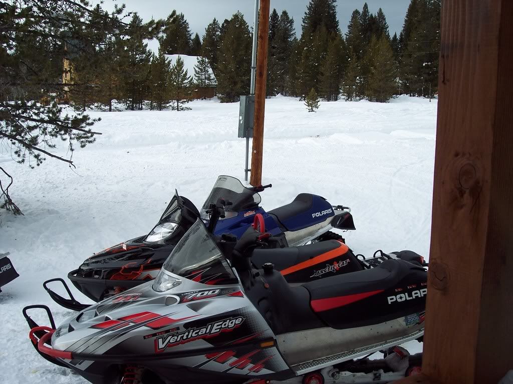
This pic will be a before and after for the storm.
IP08177.jpg
 
Last edited:
Premium Features


Back
Top