Install the app
How to install the app on iOS

Follow along with the video below to see how to install our site as a web app on your home screen.

Note: This feature may not be available in some browsers.

  • Don't miss out on all the fun! Register on our forums to post and have added features! Membership levels include a FREE membership tier.

2010/11 Snow conditions Snowy Range

Don't waste a lot of time trying to figure how to get to 7 fools. There are tons of places that are better to ride.

It is North French Creek, between Lake Marie and Libby Flats.


In a few years we'll have to re-name it to "7,000 fools". It seems like that is where everyone wants to ride. I don't have an issue with that, except that it can sometimes be tough to get out of and around in when the snow is deep. People need to respect the conditions, but especially when riding in areas like that IMO. (It is not an area that I would suggest someone go if they are not experienced, don't have the right gear, and are not familiar with the area)
 
Last edited:
In a few years we'll have to re-name it to "7,000 fools". It seems like that is where everyone wants to ride. I don't have an issue with that, except that it can sometimes be tough to get out of and around in when the snow is deep. People need to respect the conditions, but especially when riding in areas like that IMO. (It is not an area that I would suggest someone go if they are not experienced, don't have the right gear, and are not familiar with the area)

Yep, if you miss the normal two routs it can get interesting. lol.
 
South French Creek actually. North French Creek is not near as exciting, as far as getting stuck, spending nights, and walking out.

There are a ton of holes going into South French Creek from the west/north side, and if the snow is deep, good luck getting out. Had three guys walk out of there east of Silver lake up to 130, got them about 9 that night. Got lucky, they walked out of the trees into a meadow as we were heading down the mountain to regroup.
 
Don't waste a lot of time trying to figure how to get to 7 fools. There are tons of places that are better to ride.

It is North French Creek, between Lake Marie and Libby Flats.

Ok, yeah I know there's better spots to ride! I had just never been there before and was curious. Thanks
 
Anymore if you're out on the weekends, it's darn near a superhighway down in there. Just as you're leaving Marie heading south, Tipple trailhead is on you're left--'bout 30 yards south of that you'll see the tracks heading down. Main thing is to hang to you're right, to the left is Newmy and Tog's hotel. You can also come off of Libby Flat's, about a mile and a half down T trail from 130.
If it's nice out, give 'er a whirl. Nasty and deep, not so much.
 
P1070014.jpg

P1070018.jpg

P1070011.jpg

P1070010.jpg

P1070009.jpg

P1070005.jpg

P1070024-Copy.jpg

P1070023.jpg

P1070025.jpg
 
We're gonna be out there the 18th, hopefully the chances of snow pickup this week so we can find snow like that
 
Nice pics Tog! Sunday the visiblity was a little tougher, I wish we could have ridden on Saturday. The wind was howling most of the day, some light snow, and fog that stuck to your goggles at times.

We still had fun and put on about 65 miles in the trees. There was over a foot of new snow on the deck since last Saturday - but I think most of that fell last Saturday night right after we shoveled it. We hit a few landmines in places where I would expect to, but for the most part the base is there and is set up.

IMG_2677.jpg


IMG_2682.jpg


IMG_5516.jpg


IMG_5521.jpg


tk
 
Rode Saturday and Sunday. Great early season riding. Rode and stayed on the west side, "The Place." Sunday, fog/snow rolled in and visibility went to crap. Did see a yearling elk in a tree-well at about 9000 feet, way to high up this time of year, not good. Heres a few pics:
IMG00019-20101212-1411.jpg

IMG00020-20101212-1419.jpg

154877_1242379596189_1730323022_441503_7913914_n.jpg

DSC03194.jpg

DSC03193.jpg
 
We saw some tracks on Sunday but no animals. We saw the tracks at 9,000 to 9,500 feet - hopefully they were headed downhill for the winter....

Looks like the visibility was crap all over the mountain on Sunday - and the fog cloud wasn't just following us around all day :)
 
Avy Forcast 12.17.X

Backcountry Avalanche Forecast for Front Range

Issued: 12/17/2010 7:01 AM by Brian Lazar

Highlights
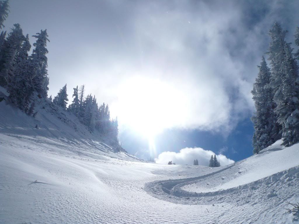
No new snowfall to report for the Front Range zone this morning, but we did see 5 to 10" of new snow in parts of the zone from yesterday, and winds just barely strong enough to transport and build fresh soft shallow slab. We have a break in the moisture today, until the next system moves into the state this afternoon, and snowfall begins to ramp up tonight. This next system looks impressive, and we should see some healthy snowfall totals over the weekend. Time to start thinking about what kind of load it will take to trigger those deeper buried weak layers.

Avalanche Danger
The avalanche danger for the Front Range zone is CONSIDERABLE (Level 3) on north through east through southeast aspects steeper than 35 degrees above treeline where the storm slab has stiffened. Skier triggering of the storm slab is likely in these terrain features. Elsewhere near and above treeline, the danger is MODERATE (Level 2). Skier triggering of the deeper slab is possible where the slab thins. Below treeline, the danger is MODERATE (Level 2) on north through southeast aspects, and LOW (Level 1) on other aspects.

Snow & Avalanche Discussion
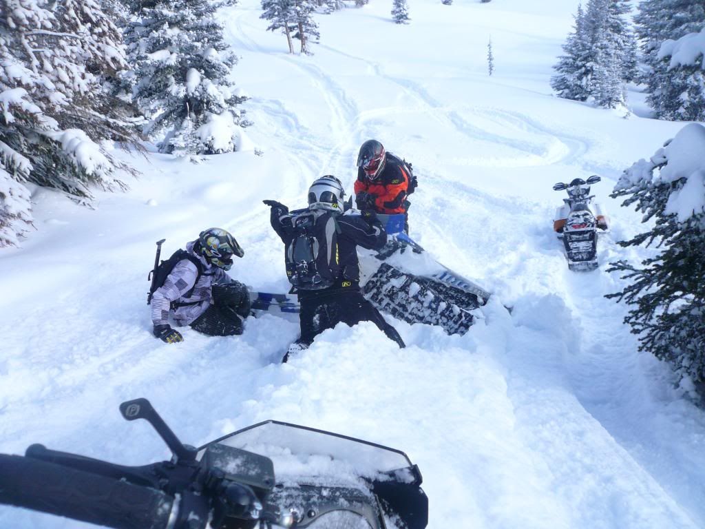
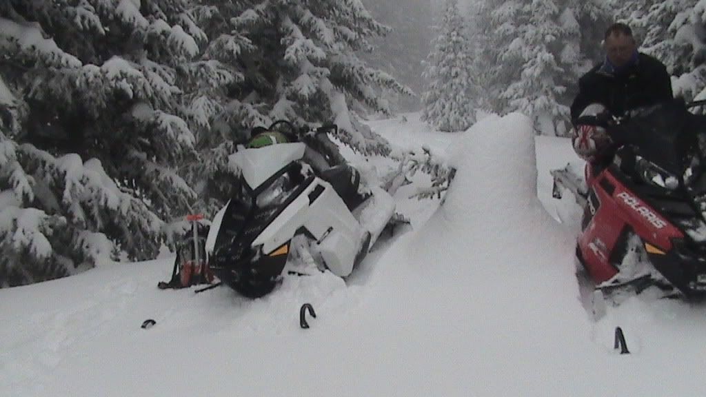
The recent storm snow and moderate westerly winds at higher elevations combined to build fresh soft shallow slab. Yesterday, a skier in the Jones Pass area triggered this slab on a north aspect at approximately 12,500 feet. The slab was 600 feet wide, 1 to 1.5 feet thick, and ran about 500 vertical feet. The slide piled up 4-8 feet of debris, and partially buried the skier, but there were no injuries. This stiffening storm slab is one of the primary avalanche concerns today, and will be most easily triggered on steep north through east through southeast aspects above treeline. Danger will rise over the weekend with up to a foot of snowfall accumulating by Monday morning.

The other concern remains the deeply buried weak layers associated with the October crust and the mid-November dry period. While these deeper slabs are hard to trigger, when they do release, they are producing some large avalanches. Examples of this include several explosive, and one snowmobile, triggered avalanche since the weekend. These slides were deep, wide, and ran a long way. Hard slabs are scary because while the likelihood of triggering these may be small, the consequences of doing so are big. Hard slabs often lure backcountry travelers well out onto the slab before they release, and make escape difficult. You're mostly likely to trigger these deep hard slabs on steep (35 degrees or greater) north through east though southeast aspects near and above treeline, and in areas where the slab is thinner. This condition exists along the boundaries of cross-loaded terrain features, and along the bottom edges of start zones near ridgetops. Be cautious while traveling through any transitions in the terrain that produce obvious changes in snowpack thickness.
 
AVY WATCH!

Avalanche Watch in Effect through 12/21/2010 9:00 AM
The Colorado Avalanche Information Center has continued the Avalanche Watch for many mountainous areas of Colorado through Tuesday morning. Dense heavy snow and strong winds are causing dangerous avalanche conditions. Areas of HIGH (Level 4) avalanche danger exist and will grow in size as more snow and wind arrive.

8:45 AM by Ethan Greene: Considerable (3) avalanche danger today. More snow and wind coming. Avalanche Watch still in effect.
 
Premium Features


Back
Top