Install the app
How to install the app on iOS
Follow along with the video below to see how to install our site as a web app on your home screen.
Note: This feature may not be available in some browsers.
You are using an out of date browser. It may not display this or other websites correctly.
You should upgrade or use an alternative browser.
You should upgrade or use an alternative browser.
Alpine, Wyoming Snow Report Rockin' M Ranch
- Thread starter rockinmranch
- Start date
I've had 2 differen't groups (avalanche) probe up high in the top of Willow creek area and both said 12-13' feet. Plenty of snow at all elevations. Rode Bedford area Saturday. Soft and powdery over 8000'. We all know there are many unstable layers out there, yet I did not see a single sign of a recent slide. I'm sure it will be great snow after the Friday/Saturday Storm. Considering it was a slow start to the winter, it has caught up to where it should be, at least here in the Star Valley/Alpine, area. There is a lot of season left. Hope it stays cool.
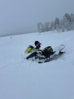
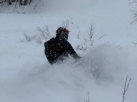
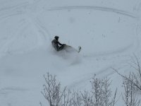
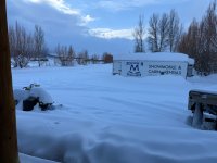
Thanks for staying with us!! You probably couldn’t have hit the conditions much better. Hope to see you in the future.I want to give a shout out to Rob and the Rockin M! Awesome place to stay and he hooked us up with some good riding. We extended our stay by a couple days and he hooked us up!. Thanks Rob! If you want a fun place to stay and ride, hit up the Rockin M!View attachment 417519View attachment 417521View attachment 417520
any updates to share?Thanks for staying with us!! You probably couldn’t have hit the conditions much better. Hope to see you in the future.
We picked up about 3-4 wet inches here at the cabins today. More predicted overnight and for Monday.
December 17, 2024
Alpine Wyoming Snow Report Rockin’ M Ranch
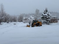
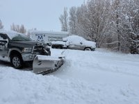
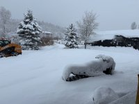
We were off to a slow start, but all is looking pretty good now heading into the holidays. A few days ago we picked up 4-6” here at the cabins. Reports of 12” plus from my neighbors, a few hundred feet higher. We just woke up to 12” plus this morning. Just measured 16” on my truck that I parked before the weekend. This is really good wet snow. Reports of decent riding before this storm, should be great now . Our local ski resorts are reporting 12” in the last 48 hours. Snotel sites are not currently reading. There was a solid foot plus, a few days ago. Gotta believe 2-3 feet in the last 3-4 days is likely. For those looking for a holiday get away, we still have cabins available from now through new years. Rockin’M Ranch 307-654-2288.
Attachments
December 28, 2024
We have been in the bullseye for snow the last week. Since my last report 10 days ago we started with a warmer storm. It rained on the valley floor for a couple of days. The snow line was about 6500 feet. We sit at 5800. Good for the base. Yesterday I shoveled 13" off my deck from the last few days and another 6" came last night. The Alpine area has been getting significantly more snow than the surrounding areas. My nephew guides at Togwotee and he said they have not been getting the storms that we have. He said he can still see his tracks from 2 weeks ago. 3 more storms are in line to hit in the next few days. Snotel sites are as follows: Willow Creek (Bedford/Thayne) 50", Spring Creek Divide (Afton) 42", Blind Bull Snotel (Wyoming Range Greys River Area) 40".
Summary from BTNF avalanche report:
A Winter Storm Warning remains in effect until 11 am MST Monday
Over the past 48 hours, periods of light to moderate snow showers has deposited the following amounts by zone:
Tetons: 12-17” snow with 1-1.5” snow water equivalent (SWE)
Snake River Range: 10-16”/1.5”
Salt/Wyoming Ranges: 10-12”/1”
Togwotee: 4-6”/.5
Over the past 24 hours, snowfall totals by zone are:
Tetons: 4-7”
Snake River Range: 3-6”
Salt/Wyoming Ranges: 3-5”
Togwotee: 1-2”
Ridgetop winds have been on the uptick, with averages climbing into the 25 mph range out of the southwest during the overnight hours in both the Tetons and Salt/Wyoming ranges. Other zones are experiencing slightly lower wind speeds, in the 15-20 mph range. Temperatures have remained relatively stable, in the low to high teens at 10,000 feet and mid to high twenties in the valleys.
Today will see a continuation of this pattern, with more snow and wind. By sunset, expect an additional 4-8” of snow in the Tetons and Snake River Range, 5-10” in the Salt/Wyoming Ranges, 3-6” on Togwotee. Winds will be out of the west and southwest at 20-25 mph. Temperatures will climb into the low twenties at 10,000 feet and low thirties in the valleys.
Overnight and into tomorrow will see an increase in snowfall intensity, as additional waves of moisture impact the region.
An avalanche warning will be issued beginning at 6pm tonight and will be in effect until 6pm Sunday.
We have been in the bullseye for snow the last week. Since my last report 10 days ago we started with a warmer storm. It rained on the valley floor for a couple of days. The snow line was about 6500 feet. We sit at 5800. Good for the base. Yesterday I shoveled 13" off my deck from the last few days and another 6" came last night. The Alpine area has been getting significantly more snow than the surrounding areas. My nephew guides at Togwotee and he said they have not been getting the storms that we have. He said he can still see his tracks from 2 weeks ago. 3 more storms are in line to hit in the next few days. Snotel sites are as follows: Willow Creek (Bedford/Thayne) 50", Spring Creek Divide (Afton) 42", Blind Bull Snotel (Wyoming Range Greys River Area) 40".
Summary from BTNF avalanche report:
A Winter Storm Warning remains in effect until 11 am MST Monday
Over the past 48 hours, periods of light to moderate snow showers has deposited the following amounts by zone:
Tetons: 12-17” snow with 1-1.5” snow water equivalent (SWE)
Snake River Range: 10-16”/1.5”
Salt/Wyoming Ranges: 10-12”/1”
Togwotee: 4-6”/.5
Over the past 24 hours, snowfall totals by zone are:
Tetons: 4-7”
Snake River Range: 3-6”
Salt/Wyoming Ranges: 3-5”
Togwotee: 1-2”
Ridgetop winds have been on the uptick, with averages climbing into the 25 mph range out of the southwest during the overnight hours in both the Tetons and Salt/Wyoming ranges. Other zones are experiencing slightly lower wind speeds, in the 15-20 mph range. Temperatures have remained relatively stable, in the low to high teens at 10,000 feet and mid to high twenties in the valleys.
Today will see a continuation of this pattern, with more snow and wind. By sunset, expect an additional 4-8” of snow in the Tetons and Snake River Range, 5-10” in the Salt/Wyoming Ranges, 3-6” on Togwotee. Winds will be out of the west and southwest at 20-25 mph. Temperatures will climb into the low twenties at 10,000 feet and low thirties in the valleys.
Overnight and into tomorrow will see an increase in snowfall intensity, as additional waves of moisture impact the region.
THE BOTTOM LINE
Dangerous avalanche conditions exist. Human triggered avalanches are likely in steep terrain in the mid and upper elevations today. Natural avalanches are also possible. Travel in avalanche terrain requires careful route finding and an awareness of terrain above. The danger will be CONSIDERABLE and rise to HIGH late in the day as a continuing storm brings high snowfall rates and increased winds.An avalanche warning will be issued beginning at 6pm tonight and will be in effect until 6pm Sunday.
January 2, 2025Happy New Year! Another foot of snow overnight. Commissary is at 76", Willow Creek, 65". That's stellar depths for this time of year and I envy anyone out there right now. Why do I live in Minnesota?.....smh, lol.
That’s about what we got here…Another foot here at the cabins in the last 24 hours. I rode west on Idaho side from the cabins yesterday. Snow is good at all elevations. There was a thin crust on the snow for the first couple hundred feet down low, but that is probably gone after this last storm. Everything over 6500 feet is nice powder. Really gets thick around 7500. 4 plus feet up higher, More in the forecast through the weekend. In all, great conditions for this time of the year.
Attachments
January 11, 2025 Snow Report Rockin' M Ranch Alpine, WY
Picked up 7" here at the cabins overnight. I rode a couple of days last week on the Idaho side. Coverage is great for the first part of January. Snow seems stable at the mid to lower elevations. Good reports from the Bedford area. Willow creek is showing 12" in the last 24 hours. Went from 62" to 74". Spring Creek divide (Afton) added 7" in the last 24 hours, now 54'.
Picked up 7" here at the cabins overnight. I rode a couple of days last week on the Idaho side. Coverage is great for the first part of January. Snow seems stable at the mid to lower elevations. Good reports from the Bedford area. Willow creek is showing 12" in the last 24 hours. Went from 62" to 74". Spring Creek divide (Afton) added 7" in the last 24 hours, now 54'.
Since Rob hasn't spoken yet, I'll chime in. Conditions have been poor, with very little snow for several weeks. Fortunately, it's just starting to dump and will continue through the 7th. Gonna be a heavy wet snow, especially down low, and avy danger will likely be very high. Good chance you'll have a bluebird day on the 8th.Hey Rob,
Any updates on the conditions? We are coming to alpine on the 7th.
Thanks for always having a thread going.
Agreed. I rode to the west about 5 days ago. If you could find snow that hadn't been tracked it was good. Still found good powder at about 7000 feet. Still good coverage. Will be great with a foot or two. I will check back in a few days, after the storm...
About 4” of wet snow here at the Rockin M Ranch overnight.
We were seeing signs of cracking and propagation on slopes that were barely 30 degrees today the snow pack and wind was so weird …. We changed our ride plan about an hour in due time the unstable snow pack. Had to be cautious for sure …. But we still found a boat load of low consequence deep snow to play in today 
Another 4" of very wet heavy snow again last night. Rain/snow mix today. Willow creek snotel is up to 69" Probably gonna have to ride above 7000 to find drier snow. Avalanche danger is high.
How's things looking other than warm? Heading that way on Friday...
Have never ridden the Idaho side but have spent plenty of time to the east. Where would someone unload if they wanted to explore? Seasoned riders with avalanche gear/training.
Have never ridden the Idaho side but have spent plenty of time to the east. Where would someone unload if they wanted to explore? Seasoned riders with avalanche gear/training.
Similar threads
- Replies
- 39
- Views
- 7K
- Replies
- 7
- Views
- 2K
- Replies
- 2
- Views
- 843


