Install the app
How to install the app on iOS

Follow along with the video below to see how to install our site as a web app on your home screen.

Note: This feature may not be available in some browsers.

  • Don't miss out on all the fun! Register on our forums to post and have added features! Membership levels include a FREE membership tier.

Bearclaw Bob's 2

Thread Rating
5.00 star(s)
GOT SNOW

Good morning from Cooke city. The snowman called it right for last night. We picked up about 2 inches in town and about 5 inches on the mountain. The forecast for the rest of the week is snow. Today we should see another several inches fall. The temps will reach a high today in the mid 20's and start falling until we are below Zero. Happy HUMP DAY.

Riding in the trees will find you some untracked riding. Have a safe drive out.

AVALANCHE CONDITIONS: Cooke City

With the approaching storm, which I was hoping would be a little more robust, Mark and I went into the field separately to answer a simple question: Will the new snow bond to old surface? The answer we found was yes. Further south, a report from Cooke City indicated very good stability as well.

A stable snowpack and new snow falling onto a textured or moist surface with no weak layers is good news. Wind-loading is not. The winds have been blowing strong and loading slopes at all elevations. Yesterday these slabs were bonding well and not easily triggered, but today’s few inches will build soft slabs that might avalanche under your skis or sled. For today, the avalanche danger is rated MODERATE on all wind-loaded terrain and LOW on all others
 
Pipestone Flat Landers

:eyebrows: Thanks Bob from Arlan & gang from MN. Great breakfast & shop help. Had a good ride @ Top of the World on Tuesday. Lots of untracked snow. As Red/Green would say; Keep your stick on the Ice!!

See you next year.
 
Clear and Cold

Good morning from the frozen town. KBP, thanks for the kind words. We will see you next year. The last couple of days we've seen temp's drop to 15 below. The snowman is calling for flurries for the next couple of days. We will see temp's in the mid 20's with lows at zero or below. This will last for a few more days.

AVALANCHE CONDITIONS: Cooke City

Winds continue to be surprisingly light in the rest of the advisory area. In the Bridger Range near Bridger Bowl, Karl, Eric, and I on three separate field days found good powder, minimal wind, and stable conditions. The only avalanche activity has been very small wind slabs hardly worth mentionin

A layer of buried surface hoar exists near West Yellowstone, but it is not an issue with only a few inches of snow falling during the last 2 weeks and no avalanche activity on this layer.

Conditions are generally safe, but avalanches can still happen. Isolated places may have wind slabs like the one triggered yesterday, and odd things can happen as a skier found west of Cooke City on Tuesday when he discovered a natural avalanche (100’ wide, 1000’ vertical, unknown depth) that released on a slope he had skied on Monday. Get out and have fun but don’t let your guard down. For today the avalanche danger is rated LOW.

We still have our great prices on Helmets and much more things to offer. Stop in and check out the low, low prices we offer.

The bakery had a record breaking amount of people for breakfast today, with the number one item was the French toast and followed by the breakfast burrito. MMMMMMMM good.
__________________
 
GOT COLD, WE DO

Good morning from the frigid North. The snowman hasn't changed his mind on this cold. Morning temps are 14 below. With a 50% chance of snow. The outlook doesn't look good. Cold and COLDER. By Monday night we have a 100% chance, but at this time Red Lodge will get it again, with temp's again below zero. Canada, keep your cold weather. :face-icon-small-hap

AVALANCHE CONDITIONS: Cooke City

Calm conditions over the past few days have allowed the snowpack to achieve a state of balance. The snow that fell earlier in the week has bonded well to the old snow surface and there is little in the way of buried weak layers.

Yesterday, my partner and I skied in the southern Madison Range near Taylor Fork. We got stable results in stability tests, observed no signs of instability and felt comfortable skiing in avalanche terrain. Skiers in the Bridger Range and northern Gallatin Range found similar conditions. Without avalanches occurring in the new snow, there is not much to worry about.

Today - stable weather and stable snow make human triggered avalanches unlikely and the avalanche danger is rated LOW.
 
Ground Hog day

Good morning from Cooke City. I'm sure you've seen Ground Hog day. Well, we are in the same movie. Its repeating day after day. Now the snowman is again calling for a Winter Storm watch until Tuesday. Gee, I've heard that before. Woke up to 19 below and sunny skies. Monday night we have a 100% chance, but a temp of 10 below. For Tuesday a high of 9 above. The next report will be Tuesday.

AVALANCHE CONDITIONS: Cooke City

Not much has changed with the weather and snowpack over the past 24 hours. Winds have picked up slightly out of the west-northwest, which may have moved a little snow around in alpine terrain. In a few isolated locations, skiers or riders may encounter small wind slabs below upper elevation ridgelines. This problem is not widespread and will be easy to recognize and avoid.

Backcountry travelers may also find small areas of instability within the new snow. Yesterday, skiers outside of Cooke City triggered a few small slides that failed on a weakness about a foot deep. Although not particularly dangerous, these slides are a good reminder to keep the avalanche radar turned on.

Aside from a few isolated issues, the snowpack is generally stable. Yesterday, my partner and I skied around Mt. Blackmore in the northern Gallatin Range and observed no signs of instability. We also observed multiple people center punching the main SE face of Mt Blackmore at the same time. Although conditions are generally safe, it’s important to continue following the three main rules of backcountry travel: 1) Everyone carries rescue gear and knows how to use it. 2) Only expose one person at a time on steep slopes. 3) Always watch your partner from a safe location.

Today – generally safe avalanche conditions exist and avalanche danger is rated LOW.
 
SUNNY AND COOL

--------------------------------------------------------------------------------

Good morning. Recap from Monday. BRRRRRRR The snowman was right two times in a row. He stated we would only see flurries last night, it came true. At this time we have sun and clear, 5 above with a trace of snow. Tonight we could see 15 below. By this weekend the temp's will rise to lower 30's.

AVALANCHE CONDITION: Cooke City

Last night ahead of the storm, temperatures dropped and the wind direction shifted from west to north as speeds increased to 20 mph. Freshly formed wind slabs will be touchy today. In the two days leading up to the storm there were small avalanches triggered around Cooke City and yesterday morning the Big Sky Ski Patrol found a small avalanche, 6-10 inches deep, on an unusual wind-loaded terrain feature. Another small wind slab, about 30 feet wide, was seen on the west side of Saddle Peak yesterday. Today, the new low-density snow will be unstable if it’s been moved around by the wind.

The avalanche concern is confined to the new snow. Deeper layers in the snowpack are generally stable and I do not expect avalanches to break down into them (video). Loose snow slides are possible on steep terrain given the underlying hard surface and slopes with a wind-load may have soft slabs up to foot deep that could be triggered. For today, the avalanche danger is rated MODERATE on all wind-loaded slopes and LOW everywhere else.
 
--------------------------------------------------------------------------------

Good morning from the freezer. BRRRRRRRRRRRRRR 23 below. I've been here 29 years and never have I seen it this cold in March. Climate change or something else. Who knows. The snowman is calling for the next 7 days with :sun:
By Tuesday we could see temp's in the lower 40's. YUCK Lets all start a snow dance today and see what we can bring in.

AVALANCHE CONDITIONS: Cooke City

Yesterday I rode around Lionhead and found weak snow at the surface on all aspects and elevations. The upper six inches of the snowpack has faceted into small sugary grains from a process called near-surface faceting, or more specifically, diurnal recrystallization. Its urban slang definition is “recycled powder” since it resembles powder in its consistency. These crystals formed during repeated cycles of cold clear nights and warm(er) days and once buried they can become a long-term weak layer. On the ridge this layer was capped by a thin wind slab which will help preserve it over the coming days. Karl found the exact layer in Bacon Rind and I imagine it’s in many other places too. To learn more about it without getting all “sciency” read Karl’s 1998 article in The Avalanche Review.

Is it a problem now? No. Will it be in the future? Possibly. This week’s weather may melt it, heal it or develop it further. We’ll be monitoring it closely in anticipation of the next monster storm which is out there somewhere, right?

Weak snow at the surface does not make for unstable conditions. The snowpack is generally strong (video) and avalanches are unlikely. Wind-loaded slopes near the ridgelines have a few thin wind slabs that could be triggered, but these are not widespread (photo). For today, the avalanche danger is rated LOW on all slopes.

Guys, if you would like a group or single picture or even a picture you've taken. Stop in and I'll post it on Face book.
 
Warmer

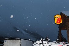
Good day from Bearclaw / bakery and Super 8 in Cooke city. We warmed up over night to 6 above. WOW a 17 degree rise. Today we will see lower 30's with a low of 15 above. For Friday through Sunday the temp's will see the upper 30's and Monday in the 40's. Still no chance of snow coming in. I guess no one helped me do a snow dance last night.

AVALANCHE CONDITIONS: Cooke City

Winds increased overnight and today the main problem to watch for will be recently formed wind slabs. In some places these wind slabs may be resting on a layer of small, weak snow crystals (near-surface facets). A snowboarder triggered a sizable wind slab yesterday near Big Sky (photo) but was not caught. It was reported to be 8-10 inches deep and about 200 yards wide. Breaking over such a wide area indicates that it may have fractured on a weak layer of facets.

Doug found this weak layer near West Yellowstone on Tuesday, Karl found it in the southern Madison Range, and USFS and USGS personnel found it near Cooke City in between several ice crusts. An avalanche forecaster from Colorado found some thin wind slabs on NE aspects south of Cooke City resting on this weak layer. Doug skied on the west and east sides of the Bridger Range near Bridger Bowl and did not find these small facets near the snow surface but he did spot a few very small wind slabs that released naturally.

There are no weak layers lurking deeper in the snowpack, and you can avoid avalanches by simply avoiding fresh wind slabs. Because these wind slabs may be sitting on facets, they may remain easy trigger through the weekend. For today, the avalanche danger is MODERATE on wind loaded slopes steeper than 35 degrees. All other slopes have a LOW danger.

Doesn't this picture make you want one. MMMMMMMM

IMG_0652.jpg
 
STill Hard

Good morning with the hard packed snow. We still haven't seen fresh snow for over 9 day now. The snowman is saying a 20 % today with a 30 % tonight of snow. We will see lower 40's today. The temp's will hold true till Tuesday.

AVALANCHE CONDITIONS: Cooke City

While the big problem is a lack of fresh powder, the main avalanche problem is wind slabs up to a foot thick resting on small, weak facets. During these dry and mostly stable conditions, I tend to park my sled and ski steep lines in the alpine, but this is exactly the terrain where wind slabs will be a problem.

Debris from these avalanches has been 1-3 feet deep and the main danger of these slides is being injured if they push you into trees or rocks or knock you off your sled. The other issue with these wind slabs is that many of them rest on weak, faceted snow like Doug found early this week near West Yellowstone. Facets will keep these wind slabs unstable for longer than normal.

Most slopes have stable snow, and these wind slabs have a spotty distribution but you need to be looking for them especially if riding in steep exposed terrain. Their location depends on localized wind patterns and less on aspect. Despite the recent avalanche activity, I’m rating the avalanche danger LOW based on the travel advice in the Avalanche Danger Scale because conditions are generally safe and stable.

Guys, don't forget to spring your clocks ahead tonight.
 
Here it is guys

Cooke City

Is winter over? This is a question I’ve heard many times over the past few days. In the short term, it appears so. Above average temperatures and dry conditions will persist over the coming days. This warm and dry pattern will not benefit riding conditions (although south facing slopes may see a corn cycle in the next few days), but it will help stabilize the existing wind slab problem that developed during this past week.

Over the past five days, multiple wind slabs have been triggered throughout the forecast area, reminding us that careful snowpack evaluation is still warranted on upper elevation, wind loaded slopes (photo, photo, photo). Fortunately, as warm and dry weather continues, the probability of triggering wind slabs will decline.

A secondary avalanche problem today will be wet snow avalanches. On south and west facing slopes, wet loose avalanches may occur in steep terrain during the afternoon hours. These slow movers will not pose a significant hazard, but could potentially generate enough force to carry or push a skier or rider into unpleasant terrain.

Today, small avalanches are possible in isolated areas, but generally safe avalanche conditions exist and the avalanche danger is rated LOW.

IMG_0655.jpg
 
Snow dance

--------------------------------------------------------------------------------

Morning from Springville. The snowman is calling for maybe an inch or two tonight. For tomorrow, we might see snow showers in the morning. I've talked with guys from West Yellowstone to Colorado, they report about the same conditions. Even the skiers are coming up from Colorado. What does that tell you. For this upcoming Monday we could see another storm come through. HELP me with the snow dance. Recap from Monday and Tuesday, warm and sunny.

AVALANCHE CONDITIONS: Cooke City

There has not been snow 12 of the past 13 days, our longest drought all winter. Yesterday’s warm temperatures softened the snow surface and a few wet loose avalanches released, but there was not widespread activity. Mark and I rode into Teepee Basin wondering if the six inch thick layer of facets on the snow surface has survived the record warmth. On many slopes it has. Anyplace we found “powder” we realized it was really recrystallized snow. Faceted, weak snow at the surface is not an issue until we get a substantial storm. On Sunday around Hyalite, Eric and I found these facets capped by a thin wind slab, but the overall stability was very good.

Even with very warm temperatures forecasted, the clouds will inhibit wet avalanche activity today. The snowpack is generally strong and stable and the avalanche danger is LOW on all slopes.
__________________
 
Fresh Snow

Good morning from a town that has fresh snow. We picked up about and 1.5 inches in town and the mountain that I could find this morning was about 5 inches. The snowman isn't going to help us much, with temp's reaching to mid 40's today and tomorrow with the weekend in the 50's. We do have another chance of snow starting Monday.

AVLANCHE CONDITIONS: Cooke City

There isn’t much to say about the avalanche danger today, and this morning’s trace of new snow will not change the situation. With a strong and stable snowpack, dry snow avalanches are unlikely. With cloudy skies today, wet snow avalanches are unlikely as well. For these reasons, the avalanche danger is rated LOW on all slopes.

Looking ahead - If the weather models are correct, we could get a decent shot of snow Sunday night and possibly more this time next week. The last two weeks of high pressure changed the shape of snow crystals at the snow surface into faceted grains that do not bond well. Any snow that feels like loose powder is actually these faceted crystals. Doug and I found them in Teepee Basin in the southern Madison Range on Tuesday mostly on shaded, north aspects. This faceted snow could become the next weak layer and cause avalanches when we get more snow and build a slab on top of it.

IMG_0656.jpg
 
Clear skies

Good morning from Cooke City. Well the snow we received yesterday is gone, plus some. We reached a temp of 40 degrees. Tomorrow we will see mid 40's and by Sunday 50. The chance of snow is 20% by Saturday. Sunday will start another round of rain and snow coming in. By Monday the chance shoots up to 80% and 70% by Monday night. The high for Monday will be in the mid 30's.
Road down to the parking lot and it still has a snow cover on it. They did go out last night and groom the trails.

AVALANCHE CONDTITIONS: Cooke City

Clear skies overnight helped the snowpack freeze making both dry snow and wet snow avalanches unlikely this morning. A few wet, point releases occurred yesterday when the sun appeared. Today with calm winds and strong sunshine there will be more loose, wet snow avalanches. As the day progresses the likelihood of wet snow avalanches will increase but they shouldn’t be very dangerous. They should be predictable in both where and when they occur; mostly on southerly aspects as the snow surface becomes wet. Today the danger of dry snow avalanches will be LOW and the danger of wet snow avalanches will rise to MODERATE.

Stop by my Face book page and join me their also. Look forward to seeing you.
 
YUCK

Not a good morning. The snowman was wrong on the temp yesterday. We reached 58.4 by 3:30 pm. The streets are getting bare and muddy. Today we will see mid 50's and by tonight a chance of rain turning into snow over night. The low will be around 30. A 70% chance of rain shower tomorrow with a high in the lower 50's. The chance of snow Sunday night is 80% with snow showers.
Monday with a 70% chance of snow in the morning.

UGGGG

AVALANCHE CONDITIONS: Cooke City

Wet loose avalanches will be today's primary concern. Instability will start on south and east facing slopes this morning and will move to west facing slopes as the day progresses.

Yesterday, I was in Beehive Basin and did not observe wet loose avalanches until mid-afternoon. Today, I expect wet loose activity to begin earlier due to the lack of freezing temperatures overnight. If you are traveling in soft, wet snow deeper than a boot top, it will be a good idea to avoid steep terrain or move to shadier aspects. Also, pay attention to obvious signs of instability such as roller balls or recent avalanche activity. These are Mother Nature’s clues that instability is on the rise.

Increasing cloud cover and stronger winds may help reduce the potential for wet loose activity today, but I would not rely heavily on these factors due to such warm temperatures.

Today, the dry snow avalanche danger will be LOW. The wet snow avalanche danger will start out LOW but will rise to MODERATE as the day progresses.
 
Disappointed

Good morning from a melting town. Was disappointed to wake up and see that we didn't have the precipitation the snowman said we could of had. Instead woke up at 4:30 am and found it to be 44 degrees. So now after looking at the radar( staying above us) and seeing what the snowman is saying. He has changed the forecast to mid 50's with a 60% chance of RAIN. Tonight a 30 % chance of rain and snow showers with a temp in the lower 30's. For Monday a chance of rain and in the mid 40's. Looking a head at the forecast, we have a chance of RAIN all week. This reminds me of the spring of 1988 when we had the huge fires in the park. We already had a RED fire alert for elevations below 6000 feet.


AVALANCHE CONDITION: Cooke City

Today, snow conditions will be a lot worse than the avalanche danger. Although temps did not drop below freezing last night, a mostly clear sky and strong winds will allow for some surface cooling which will create a crust on the snow surface. This curst might be supportable on some slopes and breakable on others.

Either way, riding conditions will be about as bad as they get today. On a positive note, if you do venture into the backcountry and brave the chunder, it's unlikely that human triggered avalanches will occur.

Looking ahead - the avalanche danger could increase if the incoming storm delivers a moderate to heavy amount of moisture. Both rain and snow are possible during this storm, which will create a mixed bag of conditions. The biggest threat over the next 24 hours will be a rain on snow event. If rain starts to fall in earnest, it will be a good idea to avoid avalanche terrain. It is unlikely that new snow accumulations will be enough to spike the avalanche hazard.

For today - generally safe avalanche conditions exist and the avalanche danger is rated LOW. If rain starts to fall today, the wet snow avalanche danger could rise to MODERATE.

Check both Bearclaw Bakery and me out on Face Book and become friends.
 
SNOW covered

--------------------------------------------------------------------------------

Afternoon from a snow covered town. Yes it did snow early this morning. When I say early, it was 3 am when it started. We picked up about 2 inches in town and about 4-6 on the mountain. We can see rain/ snow showers for today and Wednesday. Up to about 1-3 inches total. Then turning sunny for Thursday, through the weekend.

AVALANCHE CONDITIONS: Cooke City

At upper elevations last night’s cold temperatures will help the snow stability. Lower elevation slopes will be unfrozen and mushy while upper elevation starting zones will form a melt-freeze crust. We had almost four days of above freezing temperatures which started to break down the snowpack structure into a mass of moist snow that could not support bodyweight. People reported sinking to the ground in wet snow. Yesterday there were a few wet slides reported in Cooke City and a few small, wet loose avalanches in the Bridger Range. Eric and his partner skied to the top of the Ramp north of Bridger Bowl and found three days of below freezing temperatures had a negative impact on the snowpack.

The freezing line will determine snow stability. If it rains wet avalanches are possible. If it snows avalanche activity will be minimal. It was cold enough in the mountains around Cooke City to drop five inches of snow last night (.6 inches of snow water). This moist new snow will stick to slopes and not pose a big problem. It’s a mixed bag of conditions which means there’s not just one avalanche concern: moist snow underneath the frozen crust, rain on lower elevation slopes and new snow outside Cooke City. Today the avalanche danger is MODERATE on all slopes, but if it rains the danger will quickly rise to CONSIDERABLE.

IMG_0657.jpg
 
SUNNY

Sunny in Cooke city. The snowman is calling for 40's again today and for the next couple of days. By Saturday night we have a 40% chance of some thing coming in. Wait and see.
Recap of Wednesday, rain, snow, snow showers.

Not sure what the above posts are about. I think this picture was taken down at Crandall in Wy. Just to let you know the Wife doesn't use a tape measure.

Since I've been living here ( close to 30 years) I've seen this kind of season a couple of times. I've seen it snow on Mothers day ( 3 feet and power out for over 30 hours). I'm hoping we'll see a few more feet before the end of April.
That way it will extend the riding season until the end of June. My opinion, that's the best riding.

AVALANCHE CONDITIONS: City

Good news: The snowpack experienced a good freeze last night with cold, clear skies and cool temperatures this morning.

Bad news: The snowpack only refroze near the surface and probably remains wet underneath. Strong sunshine today will restart the melting process and more wet avalanches should occur.

Yesterday a rider at Lionhead near West Yellowstone spotted a large wet slide triggered early this week. The Bridger Bowl Ski Patrol triggered a large wet slide that put a sizable debris pile in South Bowl. This avalanche took most of the snowpack in the starting zone then entrained the new snow on top of a soft crust as it ran further downhill. At elevations above 9000 feet, the Big Sky Ski Patrol easily triggered dry snow wind slabs about 1 foot thick on all aspects. They were surprised with the sensitivity of these wind slabs and how far they propagated. Nearby in Beehive Basin, a skier saw a few wet slides on south facing slopes and described the snowpack as “total wet garbage.”

I don’t expect avalanches early this morning because the snowpack got pretty wet yesterday and froze overnight. There should be a short window of decent riding conditions as temperatures rise and the snowpack warms. Then, riding conditions and stability should deteriorate quickly. On all aspects below 9000 feet except due north, the snowpack will warm quickly and the avalanche danger will be CONSIDERABLE. At higher elevations or shaded north aspects, the avalanche danger will be MODERATE where the snowpack won’t heat up as fast but some fresh wind slabs may be found.
 
Premium Features


Back
Top