Install the app
How to install the app on iOS

Follow along with the video below to see how to install our site as a web app on your home screen.

Note: This feature may not be available in some browsers.

  • Don't miss out on all the fun! Register on our forums to post and have added features! Membership levels include a FREE membership tier.

Bearclaw Bob's 2

Thread Rating
5.00 star(s)
Cooke

Hey guys. Our plans to hit the Missoula area February 15th, 16th and 17th fell through because of the horrible snow conditions. I was thinking of swinging by Cooke instead. Does anyone know where a person could find rooms for 8 guys those dates? Also if anyone might want to point out where we should and shouldn't ride out there.
Thanks, Itsstock
 
Lightly snowing

Good afternoon to all. Had a lot of guys in for me to work on their sleds. Thank you. This morning we picked up another 3 inches in town. Its still lightly snowing. The snowman is calling for snow till the end of the week. With temps today in the upper 20's and rising up to the lower 40's by Friday. We could see some rain on Saturday. Lets hope not.

Had to plow yesterday, but when I finished I was able to take a run up on the mountain. I found 18 + inches, but the visibility was horrible.

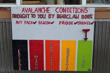
AVALANCHE CONDITIONS: Since Sunday the mountains have about an inch of snow water equivalence which has equated to a foot of snow; a little more around Cooke City and a lot less around West Yellowstone where only 4-6 inches fell. From Big Sky to West Yellowstone to Cooke City this new snow buried feathers of surface hoar on some slopes. “Some” is the word to focus on because there are many slopes with stable snow, yet some are hiding this new weak layer which could be triggered. Yesterday my partner and I rode our sleds by braille around foggy Lionhead. We dug three pits with mixed results since finding the buried surface hoar was more difficult than I anticipated. On one slope we found two layers of it, one old and one new, and determined triggering an avalanche would be possible. During a moment of better visibility we saw a small natural avalanche on a steep rollover in the new snow, which was a heads up that the freshly buried surface hoar is around and unstable. The only way to find it is to dig, but luckily that’s easy since these layers are shallowly buried.

The snowfall only ended hours ago and has not had a chance to stabilize. I anticipate the new snow will be easily triggered on steep terrain: lots of sluffs and small soft slabs. On slopes without the buried surface hoar the snowpack is strong and avalanches will be confined to the new snow. I expect some action today and am rating the avalanche danger CONSIDERABLE on slopes steeper than 35 degrees and MODERATE elsewhere. Be careful not to let your excitement for powder get in the way of good travel habits.
 
Warmer

:second:
Good morning from the tropic's. The snowman is calling for warmer temps. Today woke up to 32 above. Tomorrow the temps are going to be in the lower 40's. Saturday we could see numerous rain and snow showers in the morning. Then numerous rain and snow showers in the afternoon. The chance is 60% and drops to 40% over night.

AVALANCHE CONDITIONS: Strong winds were blowing throughout the advisory area and will make freshly formed wind slabs the main avalanche problem. Yesterday a skier in Hyalite Canyon just south of Bozeman observed many avalanches breaking within the new snow (photo). Strong winds this morning should cause more avalanches today.

A more difficult problem will be a layer of surface hoar buried 8-12 inches deep that formed last weekend. In places like Cooke City strong winds last weekend destroyed this layer on most slopes prior to recent snowfall. However, we don’t have a clear picture of where it remains. Doug found it on Lionhead near West Yellowstone on Tuesday. Where this layer exists, there may be enough of a slab on top of it to create an avalanche. I’d assume EVERY slope has this problem until you prove otherwise. If you find this layer, do several quick Extended Column Tests. Focus on whether or not a crack or a break in this layer propagates across the entire column.

With plenty of new snow, very strong winds this morning and a buried layer of surface hoar lurking on some slopes, the avalanche danger is rated CONSIDERABLE on any wind loaded slope or any slope steeper than 35 degrees. Less steep slopes without wind loading will have a MODERATE danger. There are plenty of stable slopes to be found but it will take a little investigating to ensure you’ve found one.

The number one seller at the bakery was the Breakfast Burritto, followed by the special (BST Benedict). :second:

I'm going to try and go out this afternoon, I'll take the camera with me this time.
 
WARM

Good morning to you. Woke up at 3 am to find temp at 42 degree's. The snowman is calling for gusty winds for the next two days. We'll see partly cloudy skies today. For tonight we could see numerous snow showers and up to an inch. For tomorrow, numerous snow / rain showers and a accumulation of up to 4 inches by tomorrow night with a 80% chance. Saturday night the chance goes down to 60%. Sunday, windy and mostly cloudy with a 40% chance or rain/ snow shower and mid 40's. I need help with everyone helping me do the snow dance.

AVALANCHE CONDITIONS: Wind slabs are the primary avalanche problem today. Unusually warm temperatures should help them bond to the underlying snow and be less sensitive but strong winds will continue loading slopes today. Yesterday near Cooke City, Eric and his partner triggered a small wind slab, and my partners and I found a small wind slab that had released naturally near Buck Ridge just south of Big Sky.

Before last weekend, many places had a layer of surface hoar crystals on top of the snow. This layer is buried in some areas as Doug found on Lionhead near West Yellowstone. I saw this layer on Buck Ridge last weekend, but couldn’t find it under the new snow yesterday and my partners and I confidently ripped stable powder on steep, non-wind loaded slopes. Eric and his partner couldn’t find buried surface hoar near Cooke City, and a regular observer in that area didn’t find it either. This layer does not exist in the Bridger Range.

Watch for and avoid fresh wind slabs. Also look for buried surface hoar and avoid slopes that have it because it is a notorious weak layer that surprises many avalanche professionals. This task is easy because you only need to dig 1-2 feet deep (make sure to cut a smooth wall in the snow) and look for a stripe in the snow. Today with continued strong winds the avalanche danger is rated CONSIDERABLE on wind loaded slopes and MODERATE on all others.
 
YUCK

Good afternoon from Sunny Cooke City. A recap from yesterday. WOW was I busy. The snowman was right, we had snow showers all day. We only picked up an inch, because most of it melted. The forecast doesn't look to much better. Monday we are looking at numerous snow showers in the morning turning to rain in the afternoon. With a high in the mid 30's and a 70% chance. For Tuesday the same as Monday, with a 60% chance. Wednesday. Sunny with temps in the mid 30's. Guys, I need help doing the snow dance.
Top of the World has good snow and people are still finding untouched snow. For this area its getting tracked up, but you can find great riding in the area with tree's. Howard and I went out for a quick ride yesterday and it wasn't to bad, but you couldn't see. Sorry, I didn't take a camera, because it would have gotten really wet.


AVALANCHE CONDITIONS: The southern mountains picked up 3-5 inches of heavy, dense snow yesterday. Fisher Creek Snotel Site near Cooke City recorded .7 inches of SWE (snow water equivalent) over the past 24 hours while Carrot Basing Snotel Site in the southern Madison Range picked up .6 inches of SWE. This fresh snow didn't add a ton of weight to the snowpack, but it did provide plenty of fresh ammunition for wind slabs, which will be today’s primary avalanche problem.

Other riders in the area observed a few small natural avalanches that occurred in steep, wind loaded terrain. I also observed fresh avalanche activity on wind loaded slopes in the mountains around Cooke City on Friday. Today, fresh wind slabs will remain sensitive to human triggers.

A secondary and trickier problem is a layer buried surface hoar 1-2 feet deep. Yesterday, Mark and I found this layer on a north facing slope in Teepee Creek. Doug also found this layer in the Lionhead area last Tuesday (video). This layer does not exist on all slopes, but should be looked for and assessed before committing to stepper terrain.

Today, fresh snow and strong winds will make human triggered avalanches likely on wind loaded slopes which have a CONSIDERABLE avalanche danger. Non-wind loaded slopes have a MODERATE avalanche danger.

Don't forget I do work on sleds, and carry a huge selection for Arctic cat parts.
 
Had a fun weekend in Cooke City. Snow was good in the trees, and a lot better than what we thought it would be. It was snowing like crazy today in the Daisy Pass area. I would not be surprised if they get 6 inches or more by the morning.
I lost a white shovel, the base part. It was lost somewhere between the Super 8 and the first stuck of the day, by the old buildings below Lulu Pass. If you find it, please pm me. Thanks.
 
Still snowing

Good morning from Cooke City. Monday's report was it rained in town. YUCK. Today the temp's are staying below 30. We might see some snow by tonight. The mountain picked up about a foot, while town picked up a couple of inches. The forecast for the next couple of days is Sunny to partly cloudy by Thursday. With temp's in the mid 30's.

AVALANCHE CONDITIONS: Cooke City

Once again Cooke City is in a world of its own. I don’t know why this surprises me, but it does. I love that place; it’s an anchor for winter and a beacon of hope. A foot of snow fell in the last 24 hours measuring an inch of snow water equivalency (SWE). Winds are strong enough to load slopes and these will be our main concern today. Last week Eric was able to trigger a wind slab and saw a few natural slides on slopes with a wind-load. Cooke City is a windy place, but even in the sheltered trees it will be possible to trigger small slides given all the fresh snow falling. For today the avalanche danger is rated CONSIDERABLE on all wind-loaded slopes and MODERATE on all others.


Before I get off here, the sun is trying to pop its head out of the clouds.
 
CLEAR

--------------------------------------------------------------------------------

Good morning and 23 above. The skies are clear and its going to be that way for a couple of days. Wasn't able to go out and check it out yesterday, but the report was it was colder on the top and about 10 inches of fresh powder. They even found areas of untracked snow.

The Top of the World is still good, untracked snow and about 4 inches of powder. Go check it out. Don't forget to take a couple of gallons of gas with you.

With the condition of the snow, the groomer hasn't ran, but hopefully it will change by the weekend.

AVALANCHE CONDITIONS: In the past two days 4-6 inches fell in the southern mountains with Cooke City getting over a foot. Winds have tapered and are blowing light out of the southwest. Temperatures near or above freezing will help stabilize wind slabs that formed with the snowfall. Many slopes are strong and stable but a few have a thin layer of weak grains that could avalanche from the weight of a skier or rider. This layer is 1-2 feet deep and was formed a few weeks ago. It shows up as a stripe in the snowpit wall and is easily tested. I located it on Sunday in Taylor Fork and posted a video, photo and snowpit profile of my findings. Later that day in the same vicinity a sledder triggered a small avalanche confirming the instability. Mark and Eric also found this layer in Teepee Creek on Saturday. Its distribution is spotty, but worth digging for, especially if you are thinking of punching a big line. For today, the avalanche danger is rated MODERATE on all slopes steeper than 35 degrees and LOW on less steep terrain.
 
stars ARE out

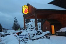
Good morning from Bearclaw and Super 8 motel. The weekend will be busy because of Presidents day. I hope everyone will have a great and safe weekend.
At this time the temp is 23 and the snowman is saying we will see cloudy skies on Thursday and Sunny for Friday and Saturday. Sunday we have a 60% chance of snow, but by Monday night and Tuesday we can see temp's below zero. AGAIN :face-icon-small-sad
AVALANCHE CONDITIONS: We'll have a short report today. The mountains near Cooke City received a foot of snow on Monday. This snow fell on a strong snowpack and the only avalanche problems are fresh wind slabs and drifts. Winds increased a little this morning compared to yesterday. Heightened avalanche conditions exist on all wind loaded slopes where the avalanche danger is MODERATE. All other slopes have a LOW danger.

Don't forget to mention Snowest when booking a room at the Super 8, you'll save money.
 
Clear

--------------------------------------------------------------------------------

Good morning from downtown Cooke city. The snowman is still calling for a 70% of snow on Sunday night. Today and tomorrow will see temp's in the mid 40's. Sunday will start a cool down for hopefully a snow storm. :face-icon-small-hap

AVALANCHE CONDITIONS: In the mountains near Bozeman, Big Sky, and Cooke City, triggering an avalanche is unlikely but not impossible. Wind slabs always remain a concern, but warm temperatures have helped wind slabs stabilize. In the northern Madison and Gallatin Ranges, a weak layer of facets and/or surface hoar exists in isolated places. A skier yesterday near Lone Mountain triggered a small avalanche on this layer on a NE facing slope around 9000 ft. There has been no other avalanche activity on this layer, but it is worth looking for since it is buried about 1 foot deep and only takes a few swipes of the shovel to find it. This layer is a problem only in a few locations; otherwise, the snowpack is generally stable and the avalanche danger is rated LOW.

Don't forget about the Top of the World for riding, its the best riding around. But don't forget to take gas with you.
If your looking for riding permits, we've got them, along with other things you might need.

IMG_0645.jpg IMG_0644.jpg
 
Cloudy

--------------------------------------------------------------------------------

Morning to everyone. I couldn't say Good, because we haven't seen snow for a while. The snowman has changed his mind for tonight. He is telling us that we have a 70% and the percentage goes up to 80% for Sunday night. So today the temp's are going to start in the lower 40's and by tomorrow the high will be mid 20's.

AVALANCHE CONDITIONS: In the mountains near Bozeman, Big Sky, and Cooke City, triggering an avalanche is unlikely but not impossible. Old stubborn wind slabs remain a concern, primarily in alpine terrain where winds have been the strongest, but warm temperatures and lack of snow have helped wind slabs stabilize. In the northern Madison and northern Gallatin Ranges, a weak layer of facets and/or surface hoar exists in isolated places. A skier near Lone Mountain triggered a small avalanche on this layer on a NE facing slope around 9000 ft. on Thursday. There has been no other avalanche activity on this layer, but it is worth looking for since it’s only buried about 1 foot deep and just takes a few swipes of the shovel to find. This layer is only a problem in a few locations; otherwise, the snowpack is generally stable and the avalanche danger is rated LOW

I've started a Face book page, go check it out.

I'll refresh peoples minds, that I do rent out a garage to work on your sleds or store your sled over night. It's nice and warm. I do fill AVALANCHE BOTTLES. rent beacons and other items that go with it.
I work on all major brands of sleds, but specialize in ARCTIC CAT and also carry parts for them.
 
Whats snow?

Good morning from Cooke city. Check out the picture what snow is. The snowman hit it right, woke up to a wonderful 2 inches of fresh powder. We will see mid 20's today and a low of 2 above tonight. The chance of snow tonight is 80%. We could pick up another couple of inches. The storm seems to be going around us. Red Lodge is looking at picking up 7 inches tonight.

AVALANCHE CONDITIONS: Similar riding conditions will be found in the mountains near Bozeman, Big Sky, and Cooke City. The one component these areas lack is a more widespread layer of buried surface hoar. In a few isolated areas around Big Sky and Hyalite, a layer of small grained facets and/or surface hoar has been found 1-2 feet deep. This layer has a very limited distribution, but should still be looked for and assessed before committing to steeper terrain. Outside of a few lingering problems, the snowpack is generally strong and stable.

Today, human triggered avalanches are unlikely and the avalanche danger is rated LOW.

Hope everyone is having a great weekend, what ever your doing.

IMG_0646.jpg
 
SADDEN

I won't be reporting for a couple of days because Terri's Mom passed away last night. My heart is with the kids and grandkids. She will be missed. :face-icon-small-sad
 
WINTER STORM WATCH

Morning from Springville. The temp's today will reach into the mid 30's, but by tonight we will be in a winter storm watch till Saturday night. Tomorrow we will see temp's in the upper 20's and snow. The predictions that well see snow is 70% and tampers off by Saturday night to 30%. Get out and help me with a snow dance.

AVALANCHE CONDITIONS: Yesterday the Bridger Bowl Ski Patrol triggered some 10 inch thick wind slabs. Skiers in the northern Bridger and northern Gallatin ranges observed winds transporting snow and forming fresh drifts and wind slabs in the typical spots under ridgelines and in steep gullies. In isolated places a thin weak layer may exists and is worth checking for. Do a quick stability test to make sure it’s not there. It’s only buried a foot or two deep, so this check should only take 5 minutes. Most slopes don’t have this weak layer and the snowpack is strong and stable as Doug found near Bridger Bowl and Eric found near Mt Blackmore on Monday. For today, the avalanche danger is rated MODERATE on wind-loaded slopes steeper than 35 degrees and LOW on all others.

I would like to say thank you for your support for Terri and the whole family.
 
Just a little

Good morning from Cooke City. The snowman was right, he called for an inch and we got it. The Winter Storm Watch was change last night to a Winter Storm Warning. Today we should see another couple of inches fall with temps in the lower 30's. Tonight we could see up to 4 inches with temp's in the teens.
By Saturday night we could see temp's fall below Zero. ( 9 below)

AVALANCHE CONDITIONS: For today with fresh wind slabs on some slopes and a buried weak layer on others, the avalanche danger is rated MODERATE on any slope steeper than 35 degrees and LOW on less steep slopes.

We rent sleds by the hour, half day, or full day. Come check them out. Great prices.

If your wandering the street early in the morning. Stop by the bakery at 5 am and get a free cup of coffee.
 
Taste of Snow

Great afternoon in Cooke City. The snowman gave us some snow over night. I took a sled for a test drive and went around the loop. I found any thing from 8 inches to a foot and a half, enough for it to come up over the hood. So the snowman is calling for a couple more inches tonight. The storm will be over by 5 am Sunday morning. Tonight we might see 21 below and a high of 11 on Sunday. By Monday, we'll be back in the lower 30's.

AVALANCHE CONDITIONS: Cooke City

The mountains near Cooke City and the southern Madison Range received 3-6 inches of snow (0.3 inches of snow water equivalent) in the last 48 hours while West Yellowstone was basically dry. Without much new snow there are few avalanche concerns. Some slopes mainly near West Yellowstone, Teepee Basin, and the Taylor Fork area may have a layer of surface hoar buried 1-2 feet deep, but this layer is not everywhere and has only produced two small avalanches that we know of. Shallow wind slabs in isolated areas will be the main concern. Today the avalanche danger is MODERATE on wind loaded slopes steeper than 35 degrees while all other terrain will have a LOW danger.

Follow me on face book and send me a friend request.

All the rental sleds went out today and also all the beacons. Thank you everyone. If you break down up in Cooke, you can use the garage to work on your own sled. I will supply the hand tools.
Don't forget about the great deals on helmets.
 
Tropics to North Pole

BRRRRRRRRRRR. From the tropics to the North Pole. The temps started falling yesterday around noon and ended up at 20 below. Today we should see 10 above and tonight 12 below with a warmer Monday. We have a chance of snow coming back in for Thursday, Friday and Saturday.

AVALANCHE CONDITIONS: Cooke City

The lack of significant snowfall in the mountains around West Yellowstone and Cooke City has helped limit the avalanche hazard. In the mountains around Cooke City, a few inches of new snow combined with moderate winds out of the northwest has likely formed shallow wind slabs in upper elevation, leeward terrain. These fresh wind slabs may be reactive the weight of a skier or rider, but their size and distribution will be limited. Outside of new snow instabilities, the snowpack around Cooke City is looking strong.


Today, human triggered avalanches area possible on wind loaded slopes and slopes steeper than 35 degrees which have a MODERATE avalanche danger. Less steep slopes without a wind load have a LOW avalanche danger.
 
More snow, who knows

Good morning from Bearclaw / Super 8. Today the snowman is showing us for snow coming in tonight till Wednesday night. We might pick up an additional 2 inches. Again we are going to see it go North around us. Red Lodge is going to pick up 6 inches. BOOOOOOO The temps will range from lower 30's today and 20 tomorrow. With lows around Zero to below Zero. The Arctic freeze isn't over yet guys.

AVALANCHE CONDITIONS: Cooke City

The southern ranges have not had fresh snow in a while, thus wind-loading is not an issue. The layer of buried surface hoar that was found on isolated slopes around Lionhead and the southern Madison Range is not reactive. Karl Birkeland skied into Bacon Rind to test this layer and found stable conditions. Reports from the Cooke City area are indicating a stable snowpack too. As the next round of snow falls we’ll be testing how it bonds to the old snow. Lack of recent snowfall and a strong, stable snowpack point to a LOW avalanche danger today.
 
Hey bob we're heading to cooke this weekend, what's the snow like? Is there any fresh left? We ride the trees usually and I'm hoping its not all like concrete. Not sure if we should plan to come a different week when it's better. Thanks.
 
Premium Features


Back
Top