Install the app
How to install the app on iOS

Follow along with the video below to see how to install our site as a web app on your home screen.

Note: This feature may not be available in some browsers.

  • Don't miss out on all the fun! Register on our forums to post and have added features! Membership levels include a FREE membership tier.

2008/2009 Turpin Meadow Ranch & Togwotee Pass/CD Trail Update

Turpin thanks for the constant updates, were heading out next Wed. the 10th. I'm trying to decide if it's worth the drive now.
 
Yes thanks for the updates, we have a group coming out to stay and ride with you early january. And I appreiciate and look forward to the updates everyday. I am still waiting for the big 2 or 3 foot storm to hit though.
 
i might as well jump on the bandwagon also and say thanks for the daily updates. let us know how the riding was today. several of us are headed your way for a sunday/monday ride and would like to know what to expect and if it is worth the drive. keep in touch.
 
Update

Thanks guys for the support. Yesterday we did ride. The trails are way to washboardish for us. But I know that the groomers are working and the Wyoming trails staff is working to have all the trails marked by the end of next week. We should great progress by next weekend. On the riding side, we went out expecting the worst. We were pleasantly suprised. We still would like to see another foot to cover those rocks. We would say that we are average for the past 10 years. We are a foot behind in snow depths compared to last year.

The forecast is for snow for the next week. We are still waiting for the "Epic Storm" to arrive. The good news is that it could happen anytime. The following is the forecast:

This Afternoon: Partly sunny, with a high near 19. West wind around 15 mph.

Tonight: A 20 percent chance of snow. Mostly cloudy, with a low around 17. West wind between 14 and 17 mph.

Saturday: A 20 percent chance of snow. Mostly cloudy, with a high near 25. Breezy, with a west wind between 13 and 20 mph.

Saturday Night: A 20 percent chance of snow. Mostly cloudy, with a low around 16. Breezy, with a west wind between 16 and 20 mph.

Sunday: A 20 percent chance of snow. Mostly cloudy, with a high near 25. West wind between 10 and 18 mph.

Sunday Night: A 50 percent chance of snow. Cloudy and breezy, with a low around 17.


The following is the Avalanche Report:

Continental Divide Trails/Togwotee Pass
Jackson Ranger District, POB 1689, Jackson WY 83001
Issued: Fri December 05, 2008 6:24 AM


M O U N T A I N - W E A T H E R - P A S T - 2 4 - H O U R S
5:00 AM Temperature at 10,400': 2º F
Maximum Temperature at 10,400' Past 24 Hours: 12º F
Average Wind Direction at 10,400' Past 24 Hours: West-Northwesterly
Average Wind Speed at 10,400' Past 24 Hours: 12 MPH
Maximum Wind Gust at 10,400' Past 24 Hours: 37 MPH
Snowfall/Prec. Past 24 Hours Brooks Lake Lodge: 0"/ 0"
Total Snow Depth 9,300´ Elevation Brooks Lake Lodge: 17"
Total Snowfall Starting October 1 Brooks Lake Lodge: 56"
Snowfall/Prec. Past 24 Hours Togwotee Mountain Lodge: 0"/ 0"

Total Snow Depth 8,700´ Elevation Togwotee Mountain Lodge: 17"
Total Snowfall Starting October 1 Togwotee Mountain Lodge: 57"


M O U N T A I N - W E A T H E R - F O R E C A S T - F O R - T O D A Y
Mostly cloudy skies.

Temperature Forecast for 8,000´-9,000´: Rising into the teens.
Ridge Top Wind Forecast for 10,000´: West to northwest at 20 to 25 miles per hour with higher gusts.
Snowfall Expected Next 24 Hours: Trace"


G E N E R A L - A V A L A N C H E - A D V I S O R Y
The General Avalanche Hazard is LOW. Above an elevation of 8,000 feet northwest winds have formed isolated pockets of soft surface slab up to one foot in depth. These surface slabs lie upon slick crusts and weak layers of faceted snow. Humans could trigger these shallow slabs in cliff areas and on steep slopes with fresh deposits of wind drifted snow. Very little snow exists below an elevation of 7,500 feet.

Ride Safe!!
 
Update

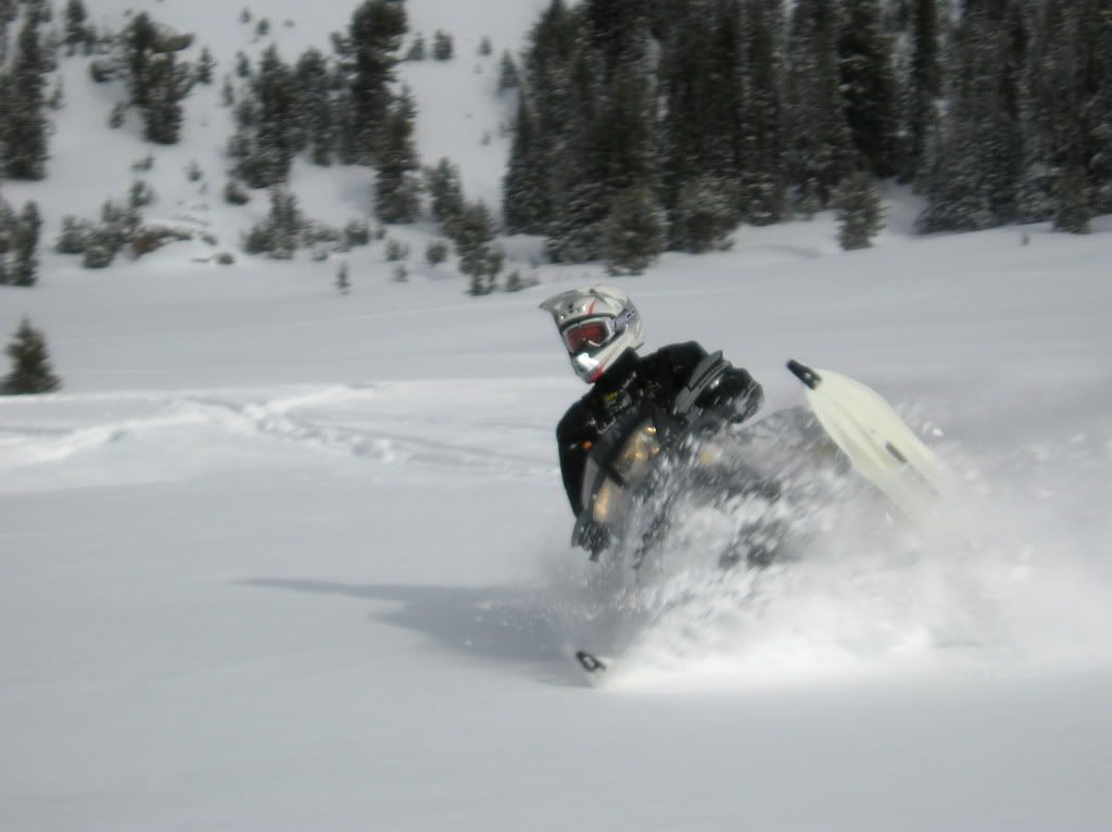
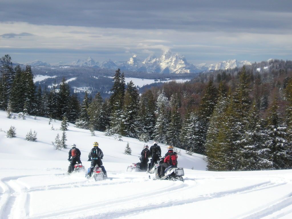
Good morning to all. The trails continue to be rough. Our next potential storm is forecasted for Sunday night. There is snow in the forecast for the next week. Our riders this weekend were pleasantly surprised with the snow. It is not as epic as last year but it is still good for early season. Togwotee pass is showing 30" of snow while at the ranch we have 4 to 6".

The following is the forecast:
Today: A 30 percent chance of snow. Mostly cloudy, with a high near 30. Breezy, with a west wind between 17 and 20 mph. Total daytime snow accumulation of less than a half inch possible.

Tonight: Mostly cloudy, with a low around 15. Wind chill values as low as -3. Breezy, with a west wind between 20 and 26 mph.

Sunday: A 20 percent chance of snow after 11am. Mostly cloudy, with a high near 25. Wind chill values as low as -3. Breezy, with a west wind between 18 and 24 mph.

Sunday Night: A 50 percent chance of snow. Cloudy, with a low around 16. Wind chill values as low as -2. Breezy, with a west wind between 15 and 24 mph.

Monday: A 50 percent chance of snow. Mostly cloudy, with a high near 16. North northwest wind between 11 and 15 mph.

Monday Night: A 20 percent chance of snow. Mostly cloudy, with a low around 7.

Tuesday: A 20 percent chance of snow. Mostly cloudy, with a high near 23.

The avalanche report is as following:
Continental Divide Trails/Togwotee Pass
Jackson Ranger District, POB 1689, Jackson WY 83001
Issued: Sat December 06, 2008 6:17 AM


M O U N T A I N - W E A T H E R - P A S T - 2 4 - H O U R S
5:00 AM Temperature at 10,400': 17º F
Maximum Temperature at 10,400' Past 24 Hours: 18º F
Average Wind Direction at 10,400' Past 24 Hours: Westerly
Average Wind Speed at 10,400' Past 24 Hours: 21 MPH
Maximum Wind Gust at 10,400' Past 24 Hours: 40 MPH
Snowfall/Prec. Past 24 Hours Brooks Lake Lodge: 0"/ 0"
Total Snow Depth 9,300´ Elevation Brooks Lake Lodge: 17"
Total Snowfall Starting October 1 Brooks Lake Lodge: 56"
Snowfall/Prec. Past 24 Hours Togwotee Mountain Lodge: 0"/ 0"

Total Snow Depth 8,700´ Elevation Togwotee Mountain Lodge: 17"
Total Snowfall Starting October 1 Togwotee Mountain Lodge: 57"


M O U N T A I N - W E A T H E R - F O R E C A S T - F O R - T O D A Y
Partly to mostly cloudy skies with a chance for some light snowfall at the highest elevations.

Temperature Forecast for 8,000´-9,000´: Rising into the 20's.
Ridge Top Wind Forecast for 10,000´: West at 20 to 25 miles per hour.
Snowfall Expected Next 24 Hours: Trace"


G E N E R A L - A V A L A N C H E - A D V I S O R Y
The General Avalanche Hazard is LOW. Isolated pockets of soft surface slab formed by northwest winds exist. These surface slabs, which are up to a foot deep, lie upon slick crusts and weak layers of faceted snow. Humans could trigger them in steep, wind loaded avalanche starting zones and cliff areas. Very little snow exists below an elevation of 7,500 feet.


We are praying for snow, EPIC SNOW!

Ride Safe.
 
Good morning to all. Our riders this weekend were pleasantly surprised with the snow.

Dennis- Yes we were pleasantly surprised. It was great to meet you this weekend and we had an AWESOME early season ride. The snow was sketchy down at the lodge level, and even at the Togwotee lodge level, but up top was awesome for the first ride out.

We sledded two days, the first day we rode the whole lava mountain area....mostly on the south side. It was great snow up top and lots of fun.

The second day we trailered to the summit and rode into the brooks lake lodge area. We tried to ride up towards Jules Bowl first but still too many stumps and rocks. STAY AWAY! We then headed up to upper brooks lake and right up on the wilderness border and it was sweet. Probably 3 to 3 1/2ft some good little climbs up through trees and plenty of fun boondocking hills right off the lake.

On the way out about half way down the road from the lodge we dropped to the southeast side by the snotel sight and the powerline and you could have played ALL DAY just right there. Snow was great and it was a ton of fun.

Again Dennis the stay was great and appreciate the hospitality. I am sure we will be back next year with another group of happy customers.:D:beer;
 
Update

Today is a beautiful day. Although it is a little bit too warm. We are forecasted to receive our first major storm of December over the next 48 hours. We are forecasted to receive 3 to 12 inches of new snow. We are praying for the at least 12 inches. The following is the forecast:

This Afternoon: Mostly cloudy, with a high near 27. West southwest wind around 9 mph.

Tonight: Snow, mainly after 11pm. Low around 16. West southwest wind between 7 and 9 mph. Chance of precipitation is 100%. New snow accumulation of 1 to 3 inches possible.

Monday: Snow, mainly before 11am. High near 23. North northwest wind between 7 and 10 mph. Chance of precipitation is 100%. New snow accumulation of 1 to 3 inches possible.

Monday Night: A 20 percent chance of snow. Mostly cloudy, with a low around 4. Wind chill values as low as -6. East northeast wind between 5 and 7 mph.

The Avalanche forecast is as follows:

Continental Divide Trails/Togwotee Pass
Jackson Ranger District, POB 1689, Jackson WY 83001
Issued: Sun December 07, 2008 7:09 AM


M O U N T A I N - W E A T H E R - P A S T - 2 4 - H O U R S
5:00 AM Temperature at 10,400': 23º F
Maximum Temperature at 10,400' Past 24 Hours: 23º F
Average Wind Direction at 10,400' Past 24 Hours: Westerly
Average Wind Speed at 10,400' Past 24 Hours: 14 MPH
Maximum Wind Gust at 10,400' Past 24 Hours: 40 MPH
Snowfall/Prec. Past 24 Hours Brooks Lake Lodge: 0"/ 0"
Total Snow Depth 9,300´ Elevation Brooks Lake Lodge: 17"
Total Snowfall Starting October 1 Brooks Lake Lodge: 56"
Snowfall/Prec. Past 24 Hours Togwotee Mountain Lodge: 0"/ 0"

Total Snow Depth 8,700´ Elevation Togwotee Mountain Lodge: 17"
Total Snowfall Starting October 1 Togwotee Mountain Lodge: 57"


M O U N T A I N - W E A T H E R - F O R E C A S T - F O R - T O D A Y
Expect partly cloudy skies this morning followed by increasing cloud cover ahead of an approaching Pacific trough.

Temperature Forecast for 8,000´-9,000´: Rising into the upper 20s.
Ridge Top Wind Forecast for 10,000´: Westerly at 15 to 25 miles per hour.
Snowfall Expected Next 24 Hours: Trace to 2"


G E N E R A L - A V A L A N C H E - A D V I S O R Y
The General Avalanche Hazard is LOW. Isolated pockets of surface slab formed by northwest winds lie upon slick crusts and weak faceted layers. These surface slabs, up to a foot deep, could be human trigger in steep, wind loaded avalanche starting zones and cliff areas. While relatively small, these slides could sweep backcountry travelers over cliff bands or into shallow, rocky terrain. Very little snow exists below an elevation of 7,500 feet.

Let it snow!!!
 
Update

This morning we are seeing white out conditions. We are hoping for snow all day. I will give an update tonight on the snow depths.

The following is the Avalanche Report:
Continental Divide Trails/Togwotee Pass
Jackson Ranger District, POB 1689, Jackson WY 83001
Issued: Mon December 08, 2008 6:48 AM


M O U N T A I N - W E A T H E R - P A S T - 2 4 - H O U R S
5:00 AM Temperature at 10,400': 15º F
Maximum Temperature at 10,400' Past 24 Hours: 26º F
Average Wind Direction at 10,400' Past 24 Hours: Westerly
Average Wind Speed at 10,400' Past 24 Hours: 16 MPH
Maximum Wind Gust at 10,400' Past 24 Hours: 38 MPH
Snowfall/Prec. Past 24 Hours Brooks Lake Lodge: 1"/ 0.07"
Total Snow Depth 9,300´ Elevation Brooks Lake Lodge: 17"
Total Snowfall Starting October 1 Brooks Lake Lodge: 57"
Snowfall/Prec. Past 24 Hours Togwotee Mountain Lodge: 1"/ 0.07"

Total Snow Depth 8,700´ Elevation Togwotee Mountain Lodge: 17"
Total Snowfall Starting October 1 Togwotee Mountain Lodge: 58"


M O U N T A I N - W E A T H E R - F O R E C A S T - F O R - T O D A Y
Expect snowfall to taper off by noon as this storm system passes. Skies will become partly to mostly cloudy by this evening.

Temperature Forecast for 8,000´-9,000´: Dropping into the teens.
Ridge Top Wind Forecast for 10,000´: Westerly at 5 to 15 miles per hour, then veering northerly later in the day.
Snowfall Expected Next 24 Hours: 1 to 2"


G E N E R A L - A V A L A N C H E - A D V I S O R Y
The General Avalanche Hazard is LOW. Isolated pockets of surface slab lie upon slick crusts and weak, faceted layers. These surface slabs, up to a foot deep, could be human trigger in steep, wind loaded avalanche starting zones and cliff areas. While relatively small, these slides could sweep backcountry travelers over cliff bands or into shallow, rocky terrain. Very little snow exists below an elevation of 7,500 feet.

I'll keep you posted.
 
Update

The sun is now shining. And the snow.....is awesome. We received 1/2 foot of new snow. Togwotee Pass is showing a snow depth of 34". The next storm is forecasted for Wednesday.

Have a great day.

Ride Safe!!
 
Update

Today is gorgeous day in Jackson Hole. We received 6 to 12 inches of new snow. We have 9" here at the ranch and the snotel site is indicating almost a 3' snow depth at Togwotee Pass. We are expecting another storm tomorrow night. The forecast is only for 2 to 4 inches. Our experience is that any storm could drop a significant amount of snow. Compared to last year, we are only 7 to 12 inches down in snow depth. One storm can make that up.


The following is the Avalanche Status:
Continental Divide Trails/Togwotee Pass
Jackson Ranger District, POB 1689, Jackson WY 83001
Issued: Tue December 09, 2008 6:57 AM


M O U N T A I N - W E A T H E R - P A S T - 2 4 - H O U R S
5:00 AM Temperature at 10,400': 1º F
Maximum Temperature at 10,400' Past 24 Hours: 15º F
Average Wind Direction at 10,400' Past 24 Hours: Northerly
Average Wind Speed at 10,400' Past 24 Hours: 6 MPH
Maximum Wind Gust at 10,400' Past 24 Hours: 19 MPH
Snowfall/Prec. Past 24 Hours Brooks Lake Lodge: 4"/ 0.2"
Total Snow Depth 9,300´ Elevation Brooks Lake Lodge: 20"
Total Snowfall Starting October 1 Brooks Lake Lodge: 61"
Snowfall/Prec. Past 24 Hours Togwotee Mountain Lodge: 4"/ 0.2"

Total Snow Depth 8,700´ Elevation Togwotee Mountain Lodge: 20"
Total Snowfall Starting October 1 Togwotee Mountain Lodge: 62"


M O U N T A I N - W E A T H E R - F O R E C A S T - F O R - T O D A Y
A northwest flow with limited moisture will bring increasing high clouds and a slight chance of light flurries.

Temperature Forecast for 8,000´-9,000´: Rising into the teens.
Ridge Top Wind Forecast for 10,000´: Northwesterly at 10 to 20 miles per hour.
Snowfall Expected Next 24 Hours: 0 to a Trace"


G E N E R A L - A V A L A N C H E - A D V I S O R Y
The General Avalanche Hazard is LOW. Beneath yesterday’s light snowfall, isolated pockets of surface slab lie upon slick crusts and weak, faceted layers. Backcountry travelers could trigger these slabs up to a foot in depth on steep, wind-loaded starting zones and cliff areas. At elevations below 7,500 feet, recent snow has fallen on mostly bare ground and avalanches are unlikely.
 
Couple o pics from last weekend.

12-06-08005.jpg


12-06-08012.jpg
 
Update

Today is another great day in Jackson Hole. We are forecasted 2" to 4" tomorrow night and then snow is forecasted for Friday. We hope a big storm is around the corner. The forecast is as follows:
This Afternoon: A 20 percent chance of snow. Mostly cloudy, with a high near 25. West wind around 7 mph.

Tonight: A 20 percent chance of snow after 11pm. Mostly cloudy, with a low around 14. West northwest wind around 7 mph.

Thursday: A 30 percent chance of snow, mainly before 11am. Mostly cloudy, with a high near 25. North northwest wind between 3 and 6 mph. New snow accumulation of less than a half inch possible.

Thursday Night: Mostly cloudy, with a low around 13. North wind at 8 mph becoming south.

Friday: A 50 percent chance of snow, mainly after 11am. Mostly cloudy, with a high near 28. South southwest wind between 5 and 15 mph.

Friday Night: Snow. Low around 14. Chance of precipitation is 100%.

The avalanche report is as follows:
Continental Divide Trails/Togwotee Pass
Jackson Ranger District, POB 1689, Jackson WY 83001
Issued: Wed December 10, 2008 5:51 AM


M O U N T A I N - W E A T H E R - P A S T - 2 4 - H O U R S
5:00 AM Temperature at 10,400': 13º F
Maximum Temperature at 10,400' Past 24 Hours: 13º F
Average Wind Direction at 10,400' Past 24 Hours: West-Northwesterly
Average Wind Speed at 10,400' Past 24 Hours: 16 MPH
Maximum Wind Gust at 10,400' Past 24 Hours: 34 MPH
Snowfall/Prec. Past 24 Hours Brooks Lake Lodge: 0"/ 0"
Total Snow Depth 9,300´ Elevation Brooks Lake Lodge: 20"
Total Snowfall Starting October 1 Brooks Lake Lodge: 61"
Snowfall/Prec. Past 24 Hours Togwotee Mountain Lodge: 0"/ 0"

Total Snow Depth 8,700´ Elevation Togwotee Mountain Lodge: 20"
Total Snowfall Starting October 1 Togwotee Mountain Lodge: 62"


M O U N T A I N - W E A T H E R - F O R E C A S T - F O R - T O D A Y
Partly cloudy skies with a slight chance of light snow.

Temperature Forecast for 8,000´-9,000´: Rising to the mid twenties.
Ridge Top Wind Forecast for 10,000´: West to northwesterly @ 15 - 20 mph.
Snowfall Expected Next 24 Hours: 0 to a Trace"


G E N E R A L - A V A L A N C H E - A D V I S O R Y
The General Avalanche Hazard is LOW. Isolated pockets of slab lie upon slick crusts and weak, faceted layers. Backcountry travelers could trigger these slabs up to a foot in depth on steep, wind-loaded starting zones and cliff areas. At elevations below 7,500 feet, recent snow has fallen on mostly bare ground and avalanches are unlikely.


Ride Safe!
 
dpsnodno- Is that Carter i see in the first pic, with the red "pull before flight" pull cord?? Riding his own dragon to or is his guide sled at tog a poo ?
 
Update

It looks like finally a big storm is heading our way. It is forecasted to be over 1 foot of new snow.

Tonight: Partly cloudy, with a low around 12. North northwest wind between 6 and 14 mph.

Friday: A 30 percent chance of snow after 11am. Mostly cloudy, with a high near 26. South wind between 5 and 13 mph. New snow accumulation of less than a half inch possible.

Friday Night: Snow, mainly after 11pm. Low around 17. South southwest wind around 14 mph. Chance of precipitation is 100%. New snow accumulation of 3 to 5 inches possible.

Saturday: Snow, mainly before 11am. High near 18. Wind chill values as low as -8. Breezy, with a west southwest wind between 18 and 23 mph. Chance of precipitation is 100%.

Avalanche Report:
Continental Divide Trails/Togwotee Pass
Jackson Ranger District, POB 1689, Jackson WY 83001
Issued: Thu December 11, 2008 6:20 AM


M O U N T A I N - W E A T H E R - P A S T - 2 4 - H O U R S
5:00 AM Temperature at 10,400': 14º F
Maximum Temperature at 10,400' Past 24 Hours: 22º F
Average Wind Direction at 10,400' Past 24 Hours: West-Northwesterly
Average Wind Speed at 10,400' Past 24 Hours: 16 MPH
Maximum Wind Gust at 10,400' Past 24 Hours: 32 MPH
Snowfall/Prec. Past 24 Hours Brooks Lake Lodge: 0"/ 0"
Total Snow Depth 9,300´ Elevation Brooks Lake Lodge: 19"
Total Snowfall Starting October 1 Brooks Lake Lodge: 61"
Snowfall/Prec. Past 24 Hours Togwotee Mountain Lodge: 0"/ 0"

Total Snow Depth 8,700´ Elevation Togwotee Mountain Lodge: 19"
Total Snowfall Starting October 1 Togwotee Mountain Lodge: 62"


M O U N T A I N - W E A T H E R - F O R E C A S T - F O R - T O D A Y
Partly cloudy skies.

Temperature Forecast for 8,000´-9,000´: Rising into the low twenties.
Ridge Top Wind Forecast for 10,000´: West-Northwesterly at 10-15 mph.
Snowfall Expected Next 24 Hours: 0"


G E N E R A L - A V A L A N C H E - A D V I S O R Y
The General Avalanche Hazard is LOW. In steep, upper elevation, wind loaded avalanche terrain, isolated pockets of slab to eighteen inches in depth could be triggered by backcountry snowmobilers or skiers. Predicting the exact location of these weak isolated areas is difficult. At elevations below 7,500 feet, recent snow has fallen on mostly bare ground and avalanches are unlikely.

Let it snow!!!
 
Update

It is a another beautiful day in Jackson Hole. And it is getting better....the forecast is for 1 to 2 feet of that beautiful white stuff....

Next week will be an awesome time to ride. Give us a call, we do have cabins still available.

The forecast:
This Afternoon: Mostly cloudy, with a high near 21. Breezy, with a west southwest wind between 17 and 23 mph, with gusts as high as 32 mph.

Tonight: Snow, mainly after 11pm. Low around 21. Windy, with a southwest wind between 23 and 33 mph. Chance of precipitation is 90%. New snow accumulation of 3 to 7 inches possible.

Saturday: Snow. High near 23. Wind chill values as low as -19. Windy, with a west southwest wind 28 to 31 mph decreasing to between 20 and 23 mph. Winds could gust as high as 40 mph. Chance of precipitation is 100%. New snow accumulation of 6 to 10 inches possible.

Saturday Night: Snow likely, mainly before 11pm. Cloudy, with a low around -5. Wind chill values as low as -27. West wind around 18 mph. Chance of precipitation is 70%.

The avalanche report
Continental Divide Trails/Togwotee Pass
Jackson Ranger District, POB 1689, Jackson WY 83001
Issued: Fri December 12, 2008 6:00 AM


M O U N T A I N - W E A T H E R - P A S T - 2 4 - H O U R S
5:00 AM Temperature at 10,400': 14º F
Maximum Temperature at 10,400' Past 24 Hours: 17º F
Average Wind Direction at 10,400' Past 24 Hours: West-Northwesterly
Average Wind Speed at 10,400' Past 24 Hours: 13 MPH
Maximum Wind Gust at 10,400' Past 24 Hours: 31 MPH
Snowfall/Prec. Past 24 Hours Brooks Lake Lodge: 0"/ 0"
Total Snow Depth 9,300´ Elevation Brooks Lake Lodge: 23"
Total Snowfall Starting October 1 Brooks Lake Lodge: 61"
Snowfall/Prec. Past 24 Hours Togwotee Mountain Lodge: 0"/ 0"

Total Snow Depth 8,700´ Elevation Togwotee Mountain Lodge: 19"
Total Snowfall Starting October 1 Togwotee Mountain Lodge: 62"


M O U N T A I N - W E A T H E R - F O R E C A S T - F O R - T O D A Y
Increasing clouds in advance of a strong winter snow storm.

Temperature Forecast for 8,000´-9,000´: Rising into the mid twenties.
Ridge Top Wind Forecast for 10,000´: Becoming Southwesterly at 20-30 mph this afternoon through Saturday morning.
Snowfall Expected Next 24 Hours: 7-10"


G E N E R A L - A V A L A N C H E - A D V I S O R Y
The General Avalanche Hazard is LOW. In steep, upper elevation, wind loaded avalanche terrain, isolated pockets of slab to eighteen inches in depth could be triggered by backcountry snowmobilers or skiers. Predicting the exact location of these weak isolated areas is difficult. At elevations below 7,500 feet, recent snow has fallen on mostly bare ground and avalanches are unlikely.


Ride Safe!!!!
 
Premium Features


Back
Top