Install the app
How to install the app on iOS
Follow along with the video below to see how to install our site as a web app on your home screen.
Note: This feature may not be available in some browsers.

You are using an out of date browser. It may not display this or other websites correctly.
You should upgrade or use an alternative browser.
You should upgrade or use an alternative browser.
10 /11 Conditions: Rabbit Ears / Buffalo Pass
- Thread starter Qreiff
- Start date
- Thread Rating
- 5.00 star(s)
So If I have a million dollar payload...simply strapping it to my truck insures it?
I have never heard of that.
I was even told that if my sleds or trailer where in my garage...and my house burned down. They would not be replaced under home owners insurance.
I don't know who your carrier is. Mine is State Farm. My sleds and everything is covered under Homeowners if damaged in (God forbid) a house fire. Also, my trailer is covered under the same policy as my truck, if it is my truck doing the pulling. I have to carry additional ins to cover the trailer and sleds if being towed by another vehicle. I also carry ins on the sleds, atvs, bikes for if they were to be damaged while out riding them. So I guess it differs from company to company, or it pays to have been using the same carrier since you were 15 1/2. State Farm lifer here. I get some pretty smoking deals since Homeowners, Life, Auto and retirement policies are carried under one Company.
thought this was a snow conditions thread
OK. It's been dumping for three days straight up there.
Looks like all snow and no sun in the forecast! I gotta say I wouldn't mind 1 bluebird day this winter. I'm not bitchen. I'm just sayin it wouldn't be a bad thing.
URGENT - WINTER WEATHER MESSAGE
NATIONAL WEATHER SERVICE GRAND JUNCTION CO
300 PM MST SUN DEC 19 2010
...HEAVY HEAVY SNOW OF EPIC PROPORTIONS EXPECTED TO LAST INTO
THURSDAY ABOVE 9000 FEET...
.HEAVY SNOWFALL OF EPIC PROPORTIONS WILL CONTINUE AND PROJECTIONS
INDICATE THAT THE STORM WILL LAST THROUGH THURSDAY. VERY MOIST AND
MILD SOUTHWEST TO WEST FLOW WILL BRING A PROLONGED PERIOD OF
HEAVY SNOW TO THE HIGHER MOUNTAINS OF EASTERN UTAH AND WESTERN
COLORADO...WITH PERIODS OF SNOW FOR COLD VALLEYS LIKE THE UINTA
BASIN AND GUNNISON VALLEY. HEAVY SNOW ACCUMULATIONS ARE EXPECTED
ABOVE 9000 FEET WITH THE HIGHEST AMOUNTS ON SOUTHWEST TO WEST
FACING SLOPES. SNOWFALL IS EXPECTED TO BE MORE INTENSE IN MANY
MOUNTAIN AREAS LATE TONIGHT THROUGH MONDAY NIGHT.
POTENTIAL IMPACTS INCLUDE EXTENDED PERIODS OF ROAD CLOSURES...INCLUDING
PRIMARY AND SECONDARY ROADS. CITIES OR TOWNS THAT MAY BE MOST
VULNERABLE WHERE ACCESS BECOMES LIMITED INCLUDE SILVERTON...CRESTED
BUTTE...AND ON TOP OF THE GRAND MESA. THE HIGHEST SNOW TOTALS ARE
EXPECTED OVER THE GRAND MESA...THE ELK AND SAN JUAN MOUNTAINS. IF
YOU RESIDE IN THESE AREAS...CONSIDER STOCKING UP ON NEEDED
SUPPLIES FOR THE NEXT FEW DAYS. THESE AREAS HAVE THE POTENTIAL OF
SEEING EPIC SNOW ACCUMULATIONS THAT MAY REACH AS HIGH AS 6 TO 8
FEET BY THURSDAY AFTERNOON. EXPECTED SNOW AMOUNTS BY ELEVATION IS
AS FOLLOWS:
ABOVE 9000 FEET...3 TO 6 FEET OF TOTAL SNOWFALL BY THURSDAY AFTERNOON
WITH SOME AREAS REACHING 8 FEET. THE HIGHEST AMOUNTS ARE EXPECTED
OVER THE GRAND MESA AND THE AREAS SURROUNDING AND INCLUDING CRESTED
BUTTE. THE AVALANCHE HAZARD IN UNDEVELOPED AREAS WILL BE ELEVATED
THROUGH MUCH OF THE WEEK.
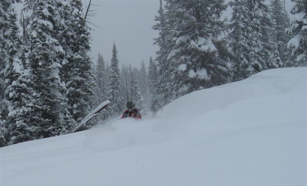
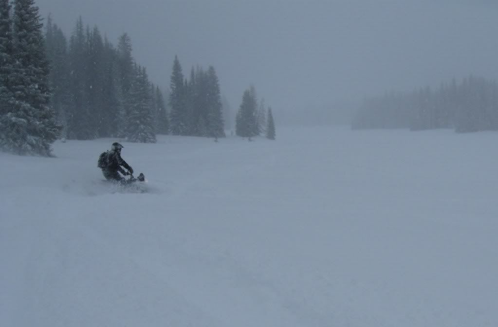
there was a ton of fresh up there! but it was very spring snowish, super wet and heavy! weird for december huh? still better then 90% of last year though!
Pretty good pow on the Ear's today.
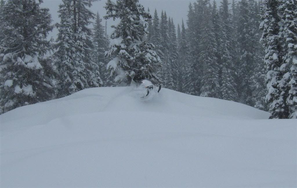
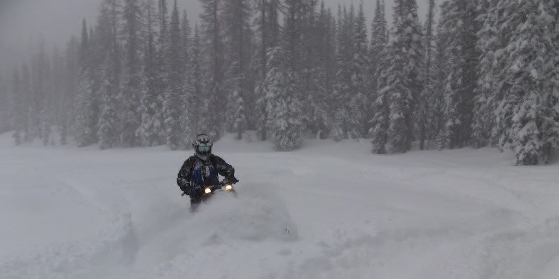
pics of this so called pow??...
Rode out of Grizzly on Sat. 30"+ of freshies while boondockin' in the trees. Very fluffy, (had zero right side bog issues) but the snow must have a ton of water content due to gloves getting wet pretty quick if you had to dig out or sweep snow. Temps weren't nasty cold but cold and comfortable, imo, but gloves and goggles had some issues. Visibility was rough due to it snowing like a banshee while on the mtn.
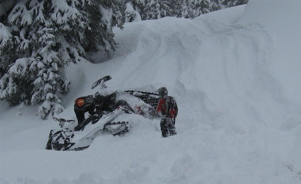
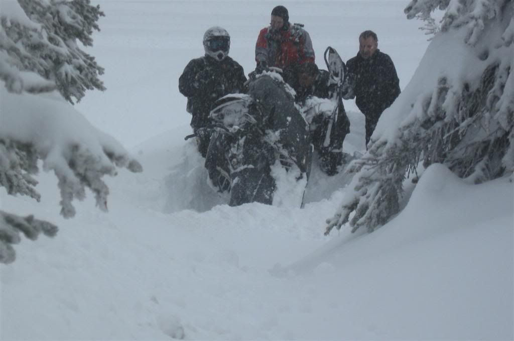
Great day.....cut short........loaded at 1:00 because I broke a spyder in my clutch and was stuck in gear. Gotta get some parts quick!!!......it's Christmas week!
 Hopefully air freight doesn't come into play..............
Great day.....cut short........loaded at 1:00 because I broke a spyder in my clutch and was stuck in gear. Gotta get some parts quick!!!......it's Christmas week!
Hopefully air freight doesn't come into play..............pics of this so called pow??...
X2!!

Great pics! Looks like it was a fun w/e. Glad I got to work Who's gonna ride xmas w/e?
Who's gonna ride xmas w/e?Sweet! I had a coolant issue that sidelined me Sat and a wife issue that sidelined me Sunday. I may just say Fawk it and ride the 25th instead of going to the inlaws, they know I hate it there anyways. Trying to figger out a way to get Friday off.
Sweet! I had a coolant issue that sidelined me Sat and a wife issue that sidelined me Sunday. I may just say Fawk it and ride the 25th instead of going to the inlaws, they know I hate it there anyways. Trying to figger out a way to get Friday off.
Curious, do you ever just go ride?


Similar threads
- Replies
- 0
- Views
- 2K