Install the app
How to install the app on iOS

Follow along with the video below to see how to install our site as a web app on your home screen.

Note: This feature may not be available in some browsers.

  • Don't miss out on all the fun! Register on our forums to post and have added features! Membership levels include a FREE membership tier.

GPS Question

What maps do you use with your Garmin 60? I bought the 60CSx in October and love it. Still figuring out which map pack to get. I'm half way to just buying Oziexplorer and making my own with downloads from USAPhotoMaps.

Do you mark where your starting point is and then use it to backtrack on the same path if required?

I use garmin's mapsource topo.
Set your waypoints to auto and I have mine set to 1/4 mile.
Then if you get lost or get into a white out condition you can just hit backtrack and it will take you from one waypoint to the next.

If you find something you like or an area you want to mark you can set a waypoint manually and when you download it to your computer you can keep that particular waypoint and download it to you GPS at anytime.
 
Mountainbigbull
I have seen the RAM mounts and they look very clean and sturdy. Have you ever had your gps "pop" out of the cradel? Like on a hard landing or something similar?

Bagger
Are those cell phone bags that you mounted to the riser?

Austin

No never, but I haven't' had any bad crashes the last few years that I have had the gps mounted like that. It's a good solid mount. The only thing I do is loop the lanyard around the the cables on the handle bar just in case there was a mishap.:D
 
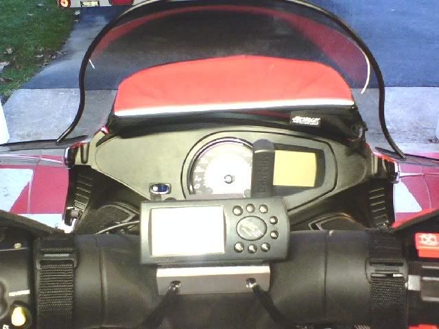
I use a Garmin 276c powered by the sled. For maps I use Garmin Topo US 2008, Canada Topo and also make custom maps.

GPS2.jpg
 
What maps do you use with your Garmin 60? I bought the 60CSx in October and love it. Still figuring out which map pack to get. I'm half way to just buying Oziexplorer and making my own with downloads from USAPhotoMaps.

Do you mark where your starting point is and then use it to backtrack on the same path if required?


OziExplorer makes great maps to print out and is a better waypoint and track manager than Garmin Topo, BUT, you can't load the Ozi maps to the GPS unit. Have to use Garmin Topo for that because Garmin uses a proprietary map file format. Have used OziExplorer since about 2000 but since getting a mapping GPS have migrated more to Topo so I don't have to make changes to 2 sets of files. But I'll update my printed maps every couple of months as I add more trails.
 
I use a Garmin 276c powered by the sled. For maps I use Garmin Topo US 2008, Canada Topo and also make custom maps.

GPS2.jpg

That looks great. I was begining to wondering if anyone was using something with a large screen. Something you can really see. Can you post some other pics, like a side view and something a little further back showing the bars too so I can get a better perspective and see the mounting? How long have you been running that setup?

Thanks,

Austin

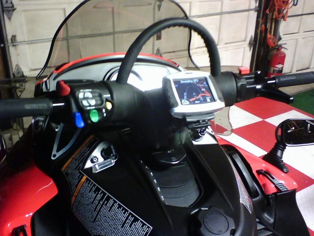
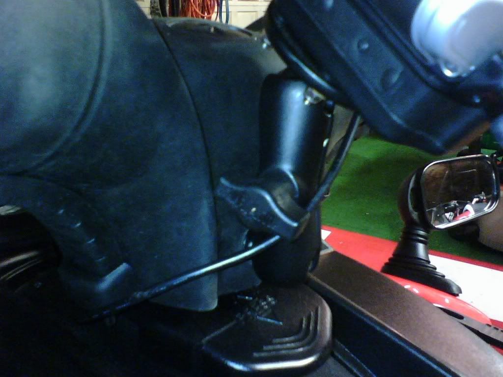
That is the only picture I have on my '08 XF 800, but here is a couple of shots of the 276c mounted on my '06 XF 700. I've had a GPS mounted on my sleds since 1997 starting out with a Garmin III Plus. I've had the 276c for 3 or 4 years now and before that a 176 for a few years. Gotta have the bigger screen....those handhelds are just too small for me.

cfsledgps276leftside.jpg


cfsledgps276side.jpg
 
I used the Ram mount cradel for my etrex vista. I made a 'oval' type mount that uses the 2 rear riser bolts that hold it to sled. The cradle mount rivets to the oval mount. The location is on top of riser, but somewhat in between the top grab bar and riser mount.

I did this to protect gps in rollerover, but visibility isn't reduced either.

I'll try and get some pics, had posted on hcs last year.

I used this mount, won't pop out.
 
Last edited:
The first pic is my old garmin on my 07 switchback. Worked great. The next pic is my new Zumo garmin on my switchback with a RAM mount that comes with it. I also use my Zumo on my bike.
windscreenbag.jpg

sledgpsventgrip-1.jpg

sledgpsmount.jpg
 
Definately Ram Mount! I use it on my sled, bike, an atv, never even thought about coming loose. I use an old Magellan Meridian. Main thing is to get one with mapping ability so you can see the trails/roads and topo. Garmin is good, and so is Magellan. Make sure it is waterproof. Also make sure you can see it in bright sun. Take it outside the shop if they will let you. I found at least a quadhelix antenna is better than a patch one, but that was years ago. I don't know what they use for antennas now. Garmin Rhinos offer radio and GPS in onw and you can see your buddies on the screen if they have them.

For batteries, I bought a 2 amp hour battery from Batteries plus and put it in my windshield bag. I rigged a cig lighter adapter to my gps. I recharge it with my battery tender.

battery
 
Premium Features


Back
Top