Install the app
How to install the app on iOS

Follow along with the video below to see how to install our site as a web app on your home screen.

Note: This feature may not be available in some browsers.

  • Don't miss out on all the fun! Register on our forums to post and have added features! Membership levels include a FREE membership tier.

US Rocky Mtn Conditions Updates 2012 season....

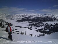
33 heads from the MomsMotorSports Club invading Island Park for a week of riding. The snow looked good upon our arrival with about 8 inches of pure fluff on the ground at the lodge. There is a nice base building in the areas that we investigated during day 1 and 2. The rocks, stumps and buried objects make for stable jumps and launch pads with the strong base. The wind from the last week is visible by noticing the pillow like pockets of fluff along with the cornices abound. We spent day 1 and 2 exploring the untracked snow both days.

Avalanche.Org Report 3-5
It’s not all gloom and doom out there. The probability of triggering avalanches is steadily decreasing, but given the poor snow structure the odds won’t hit zero anytime soon. Facets at the ground and a thin layer two to three feet under the surface are here for a while longer. Slopes with wind-loading from this weekend are still susceptible to avalanching. For today, the avalanche danger is rated CONSIDERABLE on wind-loaded slopes as well as any slope steeper than 35 degrees. All other terrain has a MODERATE danger.

Weather Report 3-6 and the following weeks report for you late season riders.
Today: Snow. High near 33. South wind 8 to 17 mph becoming northwest. Winds could gust as high as 25 mph. Chance of precipitation is 100%. Total daytime snow accumulation of 3 to 7 inches possible.
Tonight: A 30 percent chance of snow, mainly before 11pm. Mostly cloudy, with a low around -1. Wind chill values as low as -23. Blustery, with a north northeast wind between 16 and 22 mph, with gusts as high as 32 mph. New snow accumulation of less than a half inch possible.
Wednesday: Mostly sunny, with a high near 30. Wind chill values as low as -18. North northeast wind between 11 and 17 mph, with gusts as high as 25 mph.
Wednesday Night: Mostly clear, with a low around -5. Wind chill values as low as -21. North northeast wind around 10 mph.
Thursday: Sunny, with a high near 37. North wind between 6 and 9 mph becoming calm.
Thursday Night: Mostly clear, with a low around 10.
Friday: Sunny, with a high near 46.
Friday Night: Partly cloudy, with a low around 22.
Saturday: Mostly sunny, with a high near 45.
Saturday Night: Partly cloudy, with a low around 19.
Sunday: Partly sunny, with a high near 47.
Sunday Night: Partly cloudy, with a low around 19.
Monday: Partly sunny, with a high near 46.

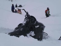
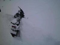
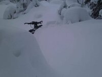
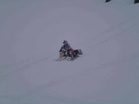
Honda400ex plowing some powder down the gully after he was convinced to drop in.
http://www.snowestonline.com/forum/attachment.php?attachmentid=170273&stc=1&d=1331043528

I can not imagine why it took convincing, doesn't this look inviting.
http://www.snowestonline.com/forum/attachment.php?attachmentid=170274&stc=1&d=1331043528

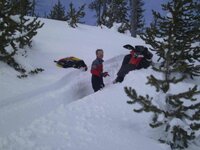
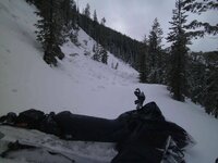
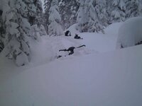
dooman92 taking a rest
http://www.snowestonline.com/forum/attachment.php?attachmentid=170275&stc=1&d=1331043528

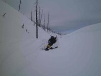
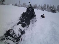
The snow is deep, stuck pointing down hill
http://www.snowestonline.com/forum/attachment.php?attachmentid=170278&stc=1&d=1331043528

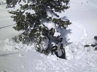
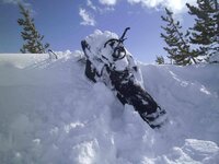
Wind blown cornice walls, lots of fun.
http://www.snowestonline.com/forum/attachment.php?attachmentid=170276&stc=1&d=1331043528

http://www.snowestonline.com/forum/attachment.php?attachmentid=170277&stc=1&d=1331043528

http://www.snowestonline.com/forum/attachment.php?attachmentid=170279&stc=1&d=1331043528
steve-plowing-pow.jpg 3-in-a-row.jpg doo-man-92.jpg jon's-wall.jpg jon's-tree-well.jpg t-trench.jpg cornice-stuck.jpg
 
More fun with the MomsMotorSports Club in Island Park.

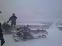
Yesterday the weather rolled in with some new snow. In the flats the wind was howling and the snow was flying, making for limited visibility. We managed to find our old stash up in the trees and avoid most of the weather for the day. Some of the guys ventured south, some went west and we went north. On the north ridge less snow and wind pushed through than the other areas. There seems to be about 3-4 inches of new fluff at the lodge. The wicked wind again has pushed the new snow into large drifts and deep pockets of fluff.

Avalanche.Org Report- Lion Head Area and Cooke City
Above freezing temperatures and direct sun melted the surface snow on east and south aspects during the last two days. Wet avalanche activity was minimal and last night’s cold temperatures refroze the surface. The ski patrols around Big Sky and an observer in Cooke City reported winds were strong enough to load slopes; no small feat given the high density (ie. creamy powder) of the surface snow. Moonlight Ski Patrol reported these new wind slabs were adhering well to the old snow surface. This is good news, but our real concern is with deeper layers. A thin layer of faceted snow about two to three feet deep is found on most slopes throughout our advisory area. It’s definitely getting stronger and will continue to get more difficult to trigger, but we can’t forget it’s there. Sitting near the ground on some slopes is depth hoar--large chains of sugary facets. On Sunday, these were breaking clean in my stability tests at the top of Truman Gulch on the backside of Bridger Bowl (video, photo). Although prevalent in the Bridger Range, we are also finding these on other slopes with a thin snow cover (Cooke City being the exception).

Snowmobilers triggered two avalanches on Cedar Mountain on Sunday and a few more on Buck Ridge over the weekend (photos). A few natural slides were seen in this area too, one yesterday low down in the trees on an east facing slope. Skiers in the southern Madison Range got a slope to avalanche from a cornice drop on Saturday. This slide released on depth hoar at the ground and had likely avalanched earlier.

Wind loads, especially with today’s new snow, will add stress to these weaker layers. During and immediately after a storm are when the snowpack is the most sensitive to triggering. For today, especially in light of today’s new snow and wind, the avalanche danger is rated CONSIDERABLE on all wind-loaded slopes. All other slopes will have a MODERATE avalanche danger.
 
Last edited:
Come on and join our convoy, west bound and rolling.
3 Rigs, 52 sleds, and and 52 heads rolled into Island Park late Saturday Night. We chased the rain out and the slushy snow started falling as we broke the last pass heading in. Sunday the temps held around the freezing mark. The day started with rain but turned to snow as we climbed only 400-500 ft in elevation. Visibility was minimal with the new snow flying. All the new/heavy snow has increased the avy danger to high. There are signs of instability and natural slides in the area. Lions Head slid on Friday with a huge crown consisting of about 2 feet of heavy snow plus a 3 foot layer underneath.
The weather turned last night, new fresh and lower temps should make for a great beginning of this week. Stay tuned for more updates.

Weather in IP this week....
Today: Snow showers likely. Mostly cloudy, with a high near 31. Light wind becoming south southwest between 10 and 13 mph. Winds could gust as high as 21 mph. Chance of precipitation is 70%. Total daytime snow accumulation of 1 to 3 inches possible.

Tonight: A 40 percent chance of snow showers, mainly before midnight. Mostly cloudy, with a low around 8. Wind chill values as low as -5. South southwest wind between 5 and 10 mph. New snow accumulation of less than one inch possible.

Tuesday: A 30 percent chance of snow showers, mainly after noon. Mostly cloudy, with a high near 36. Wind chill values as low as -6. South southwest wind between 9 and 16 mph, with gusts as high as 24 mph. New snow accumulation of less than a half inch possible.

Tuesday Night: A 30 percent chance of snow. Cloudy, with a low around 25. South southwest wind between 9 and 11 mph. New snow accumulation of less than a half inch possible.

Wednesday: A chance of rain and snow showers before noon, then a chance of rain showers. Snow level 6300 feet rising to 7300 feet in the afternoon. Mostly cloudy, with a high near 45. Calm wind becoming south southwest around 5 mph. Chance of precipitation is 40%. New snow accumulation of less than a half inch possible.

Wednesday Night: Mostly cloudy, with a low around 20.

Thursday: A slight chance of rain and snow. Snow level 6600 feet rising to 7300 feet in the afternoon. Partly sunny, with a high near 52. Chance of precipitation is 10%.

Thursday Night: Partly cloudy, with a low around 26.

Avy Report, Avalanche.org....
The Gallatin National Forest Avalanche Center is issuing a Backcountry Avalanche Warning for the southern Gallatin Range, southern Madison Range and Lionhead area near West Yellowstone. Heavy snowfall and strong winds are creating unstable conditions in the backcountry. Natural avalanches are currently large and destructive. The avalanche danger is rated HIGH on all slopes. Avalanche terrain including avalanche runout zones should be avoided.

Mountain Weather

Over the past 24 hours most areas picked up 4-6 inches of new snow with the exception of Cooke City which has picked 8 inches. Snow should continue through much of the day with an additional 4-6 inches falling by this evening. Currently, mountain temperatures are in the mid-teens to low twenties and winds are blowing predominately out of the west at 10-20 mph. Today, temperatures will warm into the high twenties to low thirties and winds will continue to blow out of the WNW at 10-20 mph. A ridge of high pressure will gradually build this evening and tomorrow looks to be a nice day.
Snowpack and Avalanche Discussion:

The southern Gallatin Range, southern Madison Range and the Lionhead area near West Yellowstone:

Over the past 7 days, Carrot Basin Snotel site in the southern Madison Range has received over 5" of SWE and Madison Plateau Snotel site near West Yellowstone has received over 4" of SWE. This significant load is stressing two distinct weak layers, one that is resting 2-3' above the ground and another located at or near the ground. Avalanches are naturally failing on both layers, resulting in large and destructive slides. Natural avalanches are bulls-eye data that the snowpack is highly unstable. With these conditions, any slide that is triggered naturally or by a skier or rider, will likely be large and unmanageable.

any-grade.jpg avy-break.jpg convoy-day.jpg convoy-ken.jpg convoy-ngt.jpg
 
The warm weather subsided for the day and night, making some fresh snow here in IP.
More fresh has made the avy conditions spike to high on all slopes. The snotel is showing a fresh 21 inches over the last 4 days. :BigSnowman The weather held yesterday around the freezing point after a fairly brisk night. The snow is still very soft in sports but the new heavy snowfall has built somewhat of a new base layer on top. The new base can provide a false sense of security as you climb and explore but, there are still multiple weak layers supporting the heavy snow.

Weather from NOAA....
Today: A 20 percent chance of snow showers after noon. Increasing clouds, with a high near 36. Wind chill values as low as -3. Calm wind becoming south southwest between 17 and 20 mph. Winds could gust as high as 28 mph.

Tonight: A 40 percent chance of snow, mainly before midnight. Cloudy, with a low around 24. South southwest wind between 13 and 16 mph becoming calm. Winds could gust as high as 24 mph. New snow accumulation of less than one inch possible.

Avy Report from Avalanche.Org......
Mountain Weather:

Winter stopped by for a visit and left a few goodies. Yesterday’s snowfall dropped 10 inches in the Bridger Range bringing their 36-hour storm total to 18 inches. Also 10 inches fell in the northern Gallatins, 6 to 10 inches fell around Big Sky and 2-4 inches fell in the southern mountains. West to southwest winds are averaging 20 mph with gusts to 30 mph under clearing skies. This morning temperatures are a chilly 5F to 10F, but should warm to the high 20s. Today will be partly cloudy and windy with more cloud cover rolling in tonight.
Snowpack and Avalanche Discussion:

The southern Gallatin Range, southern Madison Range and the Lionhead area near West Yellowstone:

The avalanche warning for the southern Gallatin, southern Madison and Lionhead areas expired, but this hardly means conditions are safe. In the past seven days these mountains got walloped with over five inches of snow water equivalency (SWE) which settled into a three foot slab of dense snow. Areas with wind-loads measured five foot thick hard slabs. Avalanche activity was widespread. Mark and Eric found natural avalanches in Lionhead that mowed down full grown trees (video). They also triggered a large avalanche from the ridgetop. I rode into Taylor Fork yesterday and could see many large slides from the previous two days (photo). As my partner and I skied along the ridge on Sunlight Basin we collapsed the depth hoar with a heart-thumping “whumph” triggering a large avalanche. Cracks shot along the ridge releasing a 3-5 feet deep hard slab that propagated at least 1,000 feet wide (video, photo). Breaking big avalanches loose from the flats is scary, breathtaking and informative; the danger is obvious.

Avalanches are sliding on depth hoar at the ground or facets mid-pack. It really doesn’t matter which layer it breaks on because these hard slab avalanches are destructive, large and deadly. A HIGH avalanche danger continues today on any slope that is wind-loaded or any slope steeper than 35 degrees. All other slopes have a CONSIDERABLE danger.

fresh.jpg bob.jpg still-deep.jpg
 
Winter visits IP. After a brief melt off and some rain last week, winter returns for a couple of days.
The temperatures yesterday were in the single digits with a blistering wind up top blowing around some fresh snow in the air. I noticed 3 types of snow over the day, ice pellets, dust and heavy flakes. The snow quit late in the afternoon only accumulating a couple of inches here at 6500ft. We managed to find some deep untracked snow.

Warm weather forecast from NOAA

Today: A chance of snow showers before noon, then a slight chance of rain. Mostly cloudy, with a high near 43. Calm wind becoming south between 6 and 9 mph. Chance of precipitation is 30%. Total daytime snow accumulation of less than a half inch possible.

Tonight: Partly cloudy, with a low around 29. South southwest wind between 6 and 9 mph becoming calm.

Thursday: Mostly sunny, with a high near 49. Calm wind becoming south southwest between 6 and 9 mph.

Thursday Night: Partly cloudy, with a low around 31. Southeast wind around 7 mph.

Friday: A 20 percent chance of showers. Mostly sunny, with a high near 51. Calm wind.

Friday Night: A 20 percent chance of showers after midnight. Mostly cloudy, with a low around 31.

Saturday: A 20 percent chance of showers. Mostly cloudy, with a high near 53.

Saturday Night: A slight chance of showers. Mostly cloudy, with a low around 26.

Sunday: A chance of showers. Partly sunny, with a high near 54.


Avy Report From Avalanche.org
In the last 24 hours the mountains got one inch of new snow in the northern ranges with 2-3 inches falling down south. Wind speeds increased last night from the west to southwest averaging 30 mph with gusts reaching 64 mph in Hyalite. This morning, under partly cloudy skies, temperatures are in the high teens in the south and mid-20s in the north. Today will remain partly cloudy and windy with mountain temperatures rising into the upper 30s.
Snowpack and Avalanche Discussion:

It has snowed every day for the last eight days in the southern mountains and seven out of those eight days in the northern ranges. The snow pipeline is shut off, but loading continues from the wind at all elevations. We have a weak, unstable snowpack and the current wind-loading will keep slopes poised to avalanche. The snowpack has not caught her breath yet. She is still adjusting to this new load. And remember, no matter what you find in your snowpits, stability tests always take a back seat to avalanche activity which is bulls-eye data that slopes are unstable.

The Bridger Range, southern Gallatin Range, southern Madison Range and the Lionhead area near West Yellowstone:

The Football Field on Saddle Peak avalanched naturally sometime before dawn yesterday (six pictures). Eighteen inches of new snow with strong winds added more load than the facets at the ground could handle. Prior to this storm, 4.5” of snow water (SWE) had been added, a very substantial load. The avalanche pulled out the entire winter snowpack and along with it, an entire season of ski tracks. Tracks are not signs of stability. I wish they were, but they are not. They fool folks time and time again. Luckily this avalanche released in the dead of night saving many lives.

The avalanche equation is simple: new snow + wind + buried facets = avalanches. Areas with the most snow had the biggest avalanches. Natural slides were large and destructive around West Yellowstone and in the southern Madisons (video). I saw many slides in Taylor Fork and triggered a large slide in Sunlight Basin on Monday (video, photo). I rode into Teepee Basin yesterday and had poor visibility, but could still make out a few new crown lines.

A HIGH avalanche danger continues today on any slope that is wind-loaded or any slope steeper than 35 degrees. All other slopes have a CONSIDERABLE danger.

bars.jpg drainage.jpg jst-bars.jpg ss.jpg wind-on-tt.jpg
 
The Flatlanders invade Cooke City again, last ride of the season.

It is still good at this point. The Miller trail out of the back of town is getting thin fast though. Haven't been up the other passes/trails yet. The hills still have a good amount of base on them for riding. The challenge is going to be getting there. The 'top' is not an option from here in Cooke. 212 coming in from Pilot Parking Lot is pretty well hit too. The pavement is showing and bare in quite a few spots.

Yesterdays avalanche report was low so some climbing was in order.

We had a phenomenal day poking around the hills and highmarking, one of the best all season even with the limited snow. We were lucky enough to have a 2-3 inch freshen up on top to make everything look good. Maybe it was the 'Hero' effect but what a day of spring riding, spiking the adrenaline with big climbs.


Avalanche.org Report

Mountain Weather:

Yesterday was sunny, but mountain temperatures only reached into the mid-30s. Under clear skies this morning temperatures are in the high teens as winds blow 10-20 mph out of the southwest. Today will be sunny with temperatures reaching the 50s as winds remain light. Tonight looks to be clear and cold again with more sunshine on Wednesday. In the valleys I’m forecasting balmy temps in the 60s along with sightings of flip-flops, shorts and pasty white legs.
Snowpack and Avalanche Discussion:

The Bridger, Gallatin and Madison Ranges, the Lionhead area near West Yellowstone and mountains around Cooke City:

Southwest Montana is going to get hit with a big storm this morning--a solar storm. The sun will be out in full spring glory with mountain temperatures easily reaching into 50s. Last night’s sub-freezing temperatures will ward off melting for a few hours, but melting is inevitable. Wet, loose snow avalanches will occur naturally on steep, sunny slopes. A thick ice crust underneath Monday morning’s new snow is a great sliding surface, but this will likely turn to mush by mid-afternoon too. Pinwheels growing in size as they roll downhill or sinking past your boot tops into wet, unsupportable snow are signs the surface snow is rapidly losing strength. Today, there are two avalanche concerns.

1. Wet, loose avalanches on any slope getting sun exposure.

2. As these wet slides slurry downhill they gain mass and could trigger a slab avalanche (both wet or dry). These avalanches would be deep since the weakest layer is large facets near the ground.

The mountains from West Yellowstone to Big Sky to the Bridger Range have deep slab instability. The entire winter’s snowpack is being supported by junk. I dug to the ground at Lionhead and found fist hardness facets trying to hold up a six foot thick pencil hardness slab (photo). Triggering a slope will require either a large load like a wet loose avalanche, or riding over a thinner spot where we could initiate a fracture in the facets. Any slab avalanche would be large and nasty. Additionally, on slopes that get direct solar radiation the snow is likely moist under the surface crusts. A moist snowpack is weaker than a dry one because frozen bonds are replaced by liquid water.

The avalanche danger today will start out as MODERATE on all slopes, but quickly rise to CONSIDERABLE on slopes getting direct sun. Wet, loose snow avalanches may appear harmless, but they can quickly carry you into terrain traps or off cliffs. And if they trigger a slab avalanche, well, all bets are off.

Outside Cooke City the probability of wet, loose avalanches will mirror the other areas. New snow from Monday is sitting on an ice crust and today these mountains will get their share of sun and above freezing temperatures. However, most slopes lack depth hoar which lessens the chance of finding any deep slab instability.

3-amigos,-over-look.jpg high-marks.jpg more-marks.jpg Rev-Kev,-Looking-at-the-bas.jpg
 
Premium Features


Back
Top