This week at Bearclaws has been great. Bob and Terri have made the accommodations absolutely cozy. The heated garage has been put to use with some early season carnage and mechanical updates. Hot coffee and fresh pastries at the Bakery is surely the best way to start of your mountain morning.
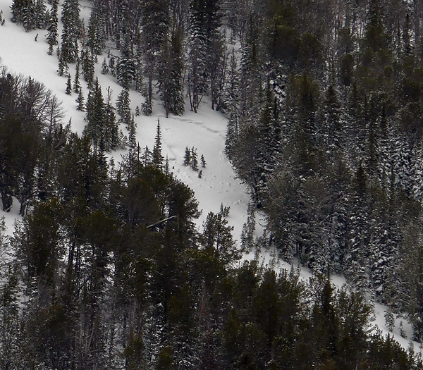
While avalanche conditions have settled, the have not completely diminished.
This picture from mtavalanche.com was taken near lulu pass.
Avalanche.Org Report
Mountain Weather:
Many valley locations remained cold yesterday, but mountain temperatures were pushing 40 F and this morning were in the high 20s F. Winds increased a little last night but lessened this morning to 15-25 mph from the W. Today a cold front just east Bozeman will keep temperatures from climbing much higher than they are this morning. Winds should blow 15-25 mph and shift to a NW direction.
Snowpack and Avalanche Discussion:
Bridger Range Gallatin Range Madison Range
Lionhead area near West Yellowstone Cooke City
The odds of triggering an avalanche have dropped since just two days ago when heavy snowfall spiked the avalanche danger. The snowpack was not producing many avalanches prior to this storm and did not produce as many avalanches as we expected following the storm.
We thought this new snow fell on a widespread layer of surface hoar, but it appears to be an issue in isolated areas versus being a widespread problem. On Tuesday Doug skied just north of Big Sky in Beehive Basin, and I rode just south of Big Sky on Buck Ridge. On most slopes the surface hoar was either not present or unreactive in stability tests. I did see a few avalanches and found the surface hoar on one slope (photo1, photo2) The heavy load of new snow also stressed facets in the bottom foot of the snowpack (video, photo) on some slopes.
What does all this mean? The snowpack overall appears to have supported this recent load of snow fairly well. Weak layers in the snowpack either do not exist or have been mostly unreactive. To be sure, dig a snowpit and perform at least one stability test. Look for a weak layer just under the new snow 1-3 feet deep. If the snowpack is relatively thin (less than 3 feet deep) assess facets in the bottom foot. Many stable slopes exist especially in the Bridger Range and near Cooke City.
It’s tricky today because pockets of instability exist where triggering an avalanche will be easy to do. Unfortunately there’s no clear pattern where these pockets exist. With heightened avalanche conditions in these specific places, the avalanche danger is rated MODERATE.
Weekend Weather Forecast
Today A 20 percent chance of snow after 11am. Partly sunny, with a high near 28. Northwest wind 5 to 7 mph.
Tonight A 30 percent chance of snow before 11pm. Mostly cloudy, with a low around 4. Wind chill values as low as -5. North wind around 6 mph becoming calm in the evening. New snow accumulation of less than a half inch possible.
Friday Partly sunny, with a high near 29. Wind chill values as low as -5. West southwest wind 3 to 7 mph.
Friday Night A 20 percent chance of snow showers after 11pm. Mostly cloudy, with a low around 13. West southwest wind 5 to 7 mph.
Saturday Scattered snow showers. Mostly cloudy, with a high near 27. West southwest wind around 11 mph. Chance of precipitation is 30%. New snow accumulation of less than a half inch possible.
Saturday Night A 50 percent chance of snow showers. Mostly cloudy, with a low around 15. New snow accumulation of less than one inch possible.
Sunday A 50 percent chance of snow. Mostly cloudy, with a high near 25. New snow accumulation of less than one inch possible.


