Install the app
How to install the app on iOS

Follow along with the video below to see how to install our site as a web app on your home screen.

Note: This feature may not be available in some browsers.

  • Don't miss out on all the fun! Register on our forums to post and have added features! Membership levels include a FREE membership tier.

2009-10 Irwin Report

Incredible Ride

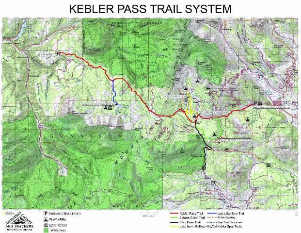
Snow has set up quite nicely and fantastic riding. My buddy and me got first tracks up to the Owen bench and then onto to Scarps Ridge. Followed a rad solo riders tracks down the Notch (he had came up it!) into Robinson and made laps - all untracked! Then back UP the Notch back over to the Rolling Hills and down the Dyke Trail with second tracks AGAIN to Kebler. Then a little Splains action on the way home. Probably my funnest day ever on a sled! But be careful on the high points, the rad solo rider kicked off a good one in Robinson.
 
Grant - sounds great!! Conditions are improving. Sounds like a dream ride!

Clint - Numb-nutz dropped the entire west wall of Barkmarker Basin yesterday. Boom. Boom. Boom. Lookouts my azz! Once they kill someone they'll take their toys away. What did they rope off???? There are NO public land closures per USFS permit.

MD.
 
Didn't see any ropes

I didn't see any ropes set up in Robinson, only two signs warning of explosives use. Not sure if they have ropes over on Barkmarker. I forsee some conflicts in Robinson. Highpointers and skiers aren't going to mesh very well. Good to see you posting Mtn Doo, sorta miss ya!
 
I didn't see any ropes set up in Robinson, only two signs warning of explosives use. Not sure if they have ropes over on Barkmarker. I forsee some conflicts in Robinson. Highpointers and skiers aren't going to mesh very well. Good to see you posting Mtn Doo, sorta miss ya!

First come first serve, If that's not good enough they can drop off the north side of Scarps into the wilderness! Don't a majority of skiers use sleds to access Irwin?
Surely you have to have a permit to set off charges intended to bring down Avy's on National Forest land.
Mark
 
Last edited:
Mark/All,

Long story short, the uber-enviro greenies that run CS Irwin (aka Irwin Backcountry Guides) now have a USFS permit and are starting approved avalanche control activities on Scarp Ridge. (Barkmarker to Robinson) The USFS accepted a plan based on "Lookouts" in lieu of actual closures - I'm sure that's going to work out well. So far they've exposed a lot of dirt and made a lot of noise with no skiing patrons in sight. (their cats are not even ready on-site yet)

Note: All Public Land above Irwin Lodge remains legally open to snowmobiling, access routes should avoid private lands near the Townsite, and Irwin Lodge. We worked hard to keep Independence Basin out of their permit area to avoid future closures during the USFS's upcoming Winter Travel Management cycle. SnoTrackers is printing maps of all of our riding areas including Scarp Ridge.

Hope this helps.

MtnDoo

BTW - when I say "uber-enviro greenies" that's because while serving as Crested Butte town council members the CS Irwin managers voted (with little/no public input) to support Hidden Gems Wilderness Campaign which will close 450,000 acres to motorized use in Colorado - including the suprise 17,000ac Whetstone addition which is right, smack-dab in the middle of our riding area (south of Splain's Gulch) - all while begging the USFS to permit their snowcat skiing area in the middle of an Inventoried Roadless Area (RARE#181) and cut new routes through the IRA forests. /rant.
 
Last edited:
I didn't see any ropes set up in Robinson, only two signs warning of explosives use. Not sure if they have ropes over on Barkmarker. I forsee some conflicts in Robinson. Highpointers and skiers aren't going to mesh very well. Good to see you posting Mtn Doo, sorta miss ya!

The signs might be all that is left, they had ropes and flagging up in the bottom north of the movie hut.

Mark, had they had their way Robinson would have been totally closed to sleds altogether. Their original plan was to shoot mortars across Robinson onto Barkmarker from the heli pad.
 
I would assume that you guys will have maps available for the forum ride as well as people available to explain where to and where not to ride for those of us who have yet to experience the beauty of the area????
 
We will indeed have maps available.

We are in the process of acquiring sponsors for our full printed 3-yr version, but either way we'll make sure that we have accurate, usable maps available for folks visiting the area.

MD.
 
<<The signs might be all that is left, they had ropes and flagging up in the bottom north of the movie hut.>>

There is an IBG/CS Irwin snowcat route from the Movie Cabin to the base of Robinson Basin that utilizes a private easement from a landowner near the south flank of Robinson. That route over the private land may be legitimately closed/roped/flagged to the snow-traveling public. There are other routes into Robinson.

The landowners up that valley are very nice folks, and we should respect their wishes. The lands outside of that private parcel as well as outside of IBG's mining claims are of course fair game to ride.

MD.
 
How many maps are needed?

I can print some on TP (regular paper when wet) buy some Ziploc bags


I will talk with Harold at Almont Lodge and see if I can leave them there so folks can stop and get one on their way up to Crested Butte.

Digger an I will be at the "y" at noon on Saturday cooking, look for the smilie face flag and or listen for some heavy metal music to find us and if that doesn't work follow your nose :face-icon-small-sho

here is the map again for those that missed it
KEBLERPASSTRAILSYSTEMMAP.jpg


way cool Trackers!! i'd be willing to spend a couple extra $$ for a good map of Kebler!

Were staying in Almont and i'd guess our cabin alone would purchase 3 of the maps, that look great btw.

Will 4M riders be able to join/enroll in the gunnison club like in the past?
 
Well, yeah - if 8' of standing base is insufficient, I suspect that there may be some northern draws up high that have more. Things are shaping up nicely.

Another storm or two between now and 4M weekend wouldn't hurt!

Pray4Snow!

MD.
 
Well, yeah - if 8' of standing base is insufficient, I suspect that there may be some northern draws up high that have more. Things are shaping up nicely.

Another storm or two between now and 4M weekend wouldn't hurt!

Pray4Snow!

MD.

That would be more than what I have seen all year. And yeah, another storm would be nice, but the rest of this week ain't lookin too good.
 
Irwin rarely disappoints. One of my top three favorite riding areas. Looking forward to putting faces to the names at the Forum ride.
 
way cool Trackers!! i'd be willing to spend a couple extra $$ for a good map of Kebler!

Were staying in Almont and i'd guess our cabin alone would purchase 3 of the maps, that look great btw.

Will 4M riders be able to join/enroll in the gunnison club like in the past?

A map on good paper will not be available until long after the ride but I can print these on 11x17 paper and put them in a ziploc back for ya all

I will print a few dozen and leave them at the lodge with Harold

I will also leave some membership forms at the lodge and digger and I will have some available at the "Y" Saturday afternoon. If I find time to make it to the lodge for dinner you can join then. someone will be there I think?
 
Current weather daily snow updates up until the ride would be really nice. Just so we kinda know what to expect. Thanks a bunch and looking forward to having a grand time.
 
If I get time

the cat has been under repair this week, we should have things cleaned up middle of next week

no new snow to report right now

Recent storms skipped to far south for us to see any accumulation
 
Premium Features


Back
Top