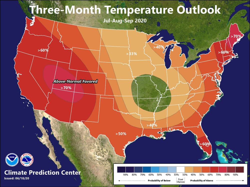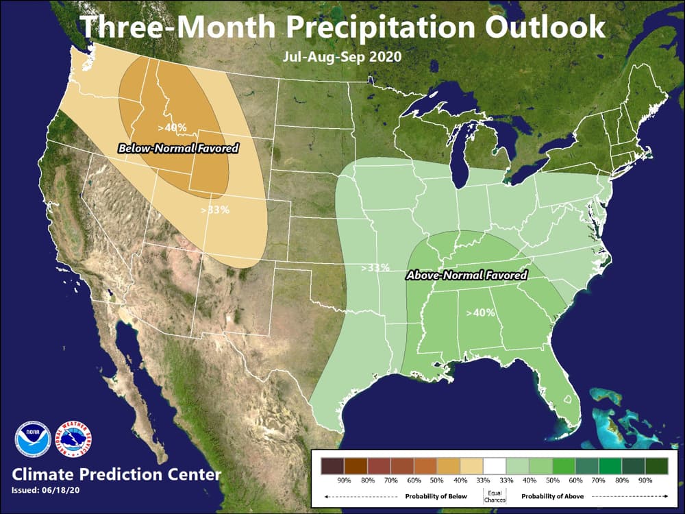
The July-August-September (JAS) 2020 temperature outlook predicts likely above normal temperatures across Alaska and most of the contiguous U.S. (CONUS), with the exception being some areas near the Central Mississippi Valley, where equal chances (EC) of below, near and above normal temperatures are indicated, according to the NOAA. The JAS precipitation outlook predicts above-normal precipitation to be likely for southern regions of Alaska, including the Aleutian Islands and the Alaska Panhandle. Above normal precipitation is also likely for much of the eastern CONUS from parts of the eastern Great Plains eastward across the Central and Lower Mississippi Valley to the Mid-Atlantic and Southeast regions and southward to the entire Gulf Coast from Texas to Florida. Below normal precipitation is favored for much of the Pacific Northwest, the Northern Rockies, and extending southeastward into the Central Rockies, parts of the northern Great Basin, and northeast regions of the Four Corners region. Equal chances (EC) of below, near, and above-normal precipitation are indicated for northern Alaska, as well as remaining areas of the Southwest CONUS, the western Great Plains, the Upper Mississippi Valley, the Great Lakes region, and the Northeast.

During the late summer and early fall season, increased chances of above-normal temperatures expand to include the entirety of the CONUS with the largest probabilities over the Southwest and Northeast. Chances of above-normal precipitation remain elevated across much of the Midwest, Southeast, and mid-Atlantic into August-September-October, while elevated chances of below-normal precipitation shift southeastward from the Pacific Northwest into northern areas of the Southwest region. In autumn 2020 elevated chances of above-normal precipitation are introduced into the Pacific Northwest and expand into the northern to central Great Plains in winter 2020-2021, then shift eastward into the Midwest by spring 2021. Increased chances of below-normal precipitation expand across the southern tier of the CONUS in September-October-November 2020 through November-December-January 2020-2021.
Equal chances (EC) are forecast in areas where the likelihood of seasonal mean temperatures or seasonal accumulated precipitation amounts are expected to be similar to climatological probabilities.

NOAA July-Aug-Sept Outlook: Above Normal Temperatures Nationwide Until Fall and Wetter for the South-East - SnowBrains
The July-August-September (JAS) 2020 temperature outlook predicts likely above normal temperatures across Alaska and most of the contiguous U.S. (CONUS),

