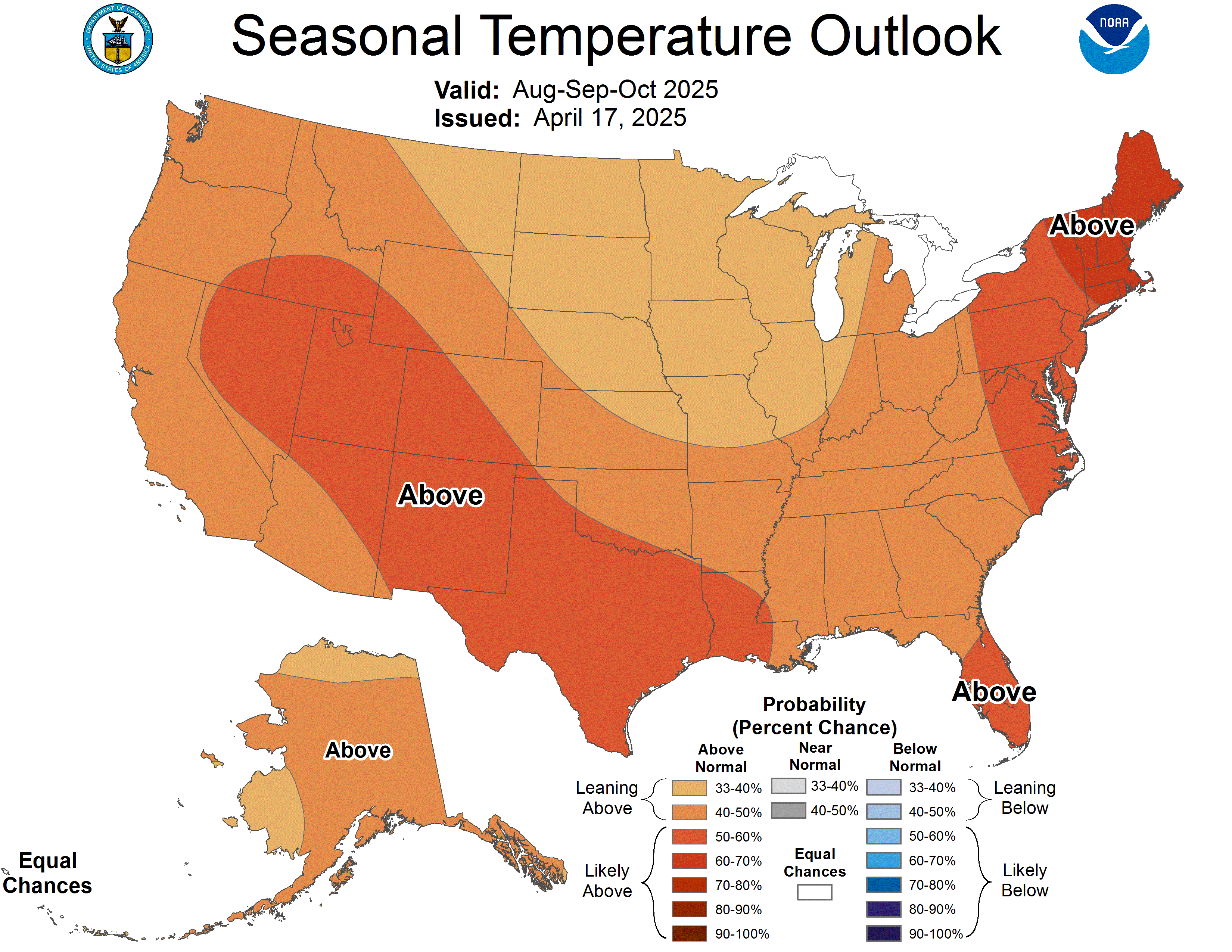
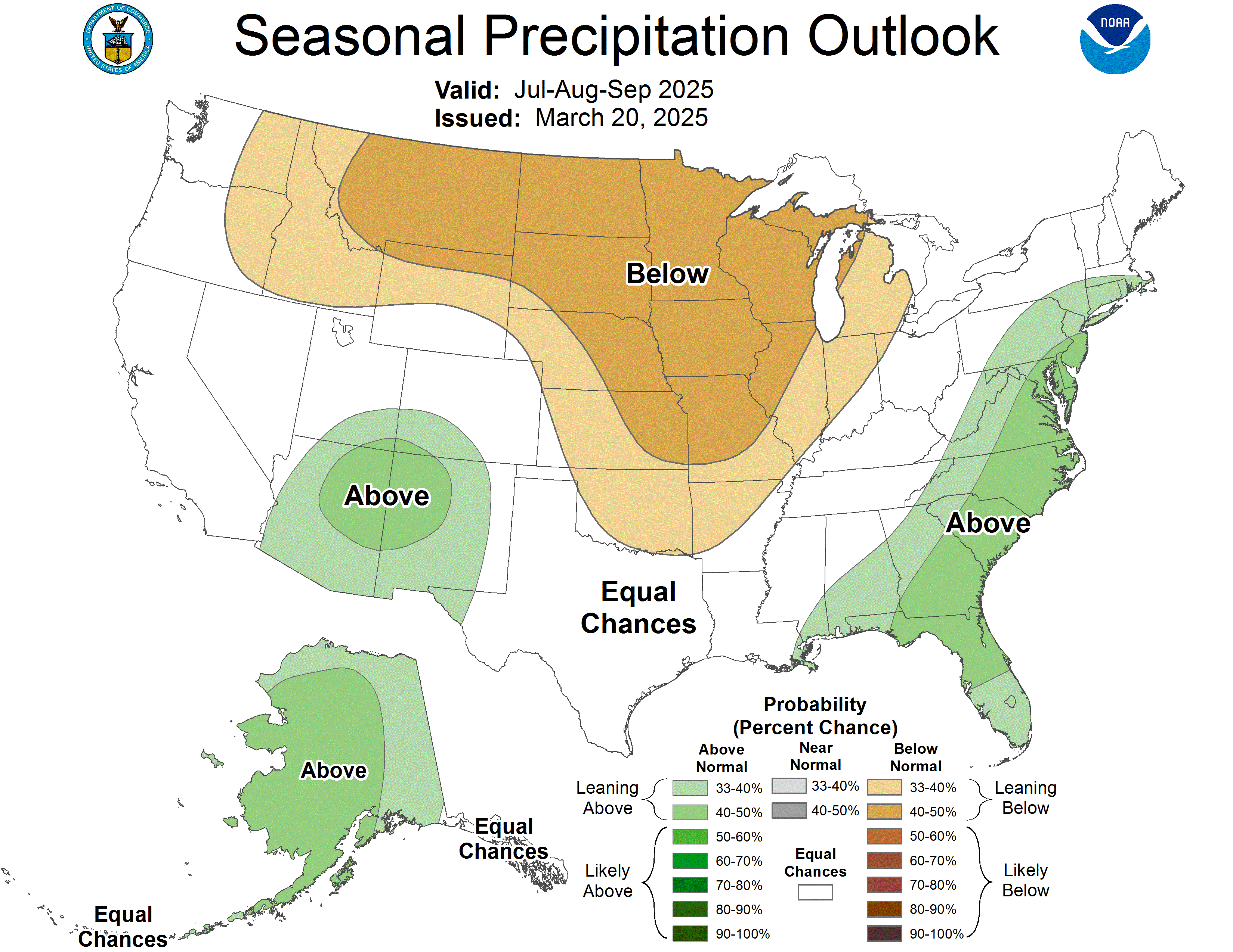
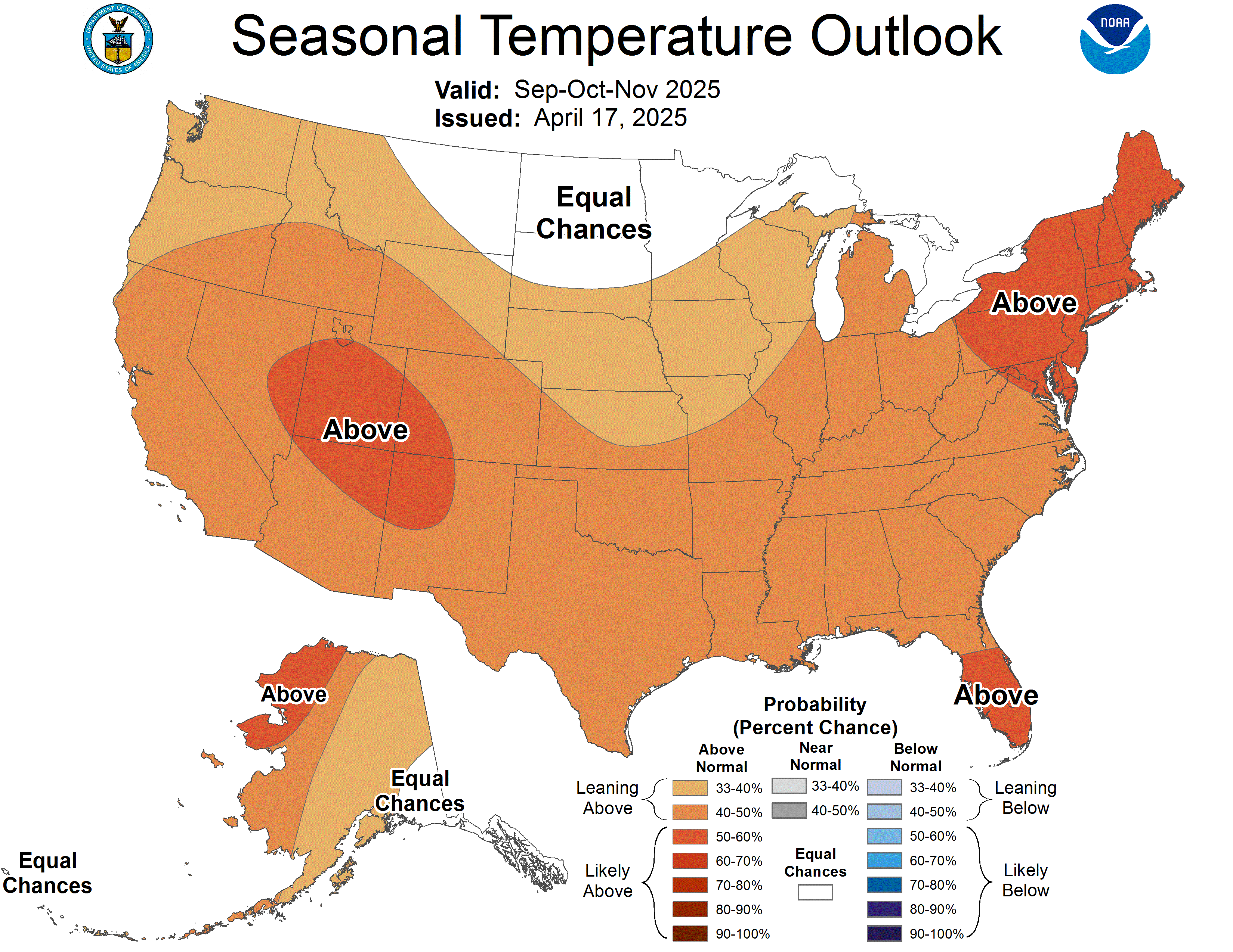
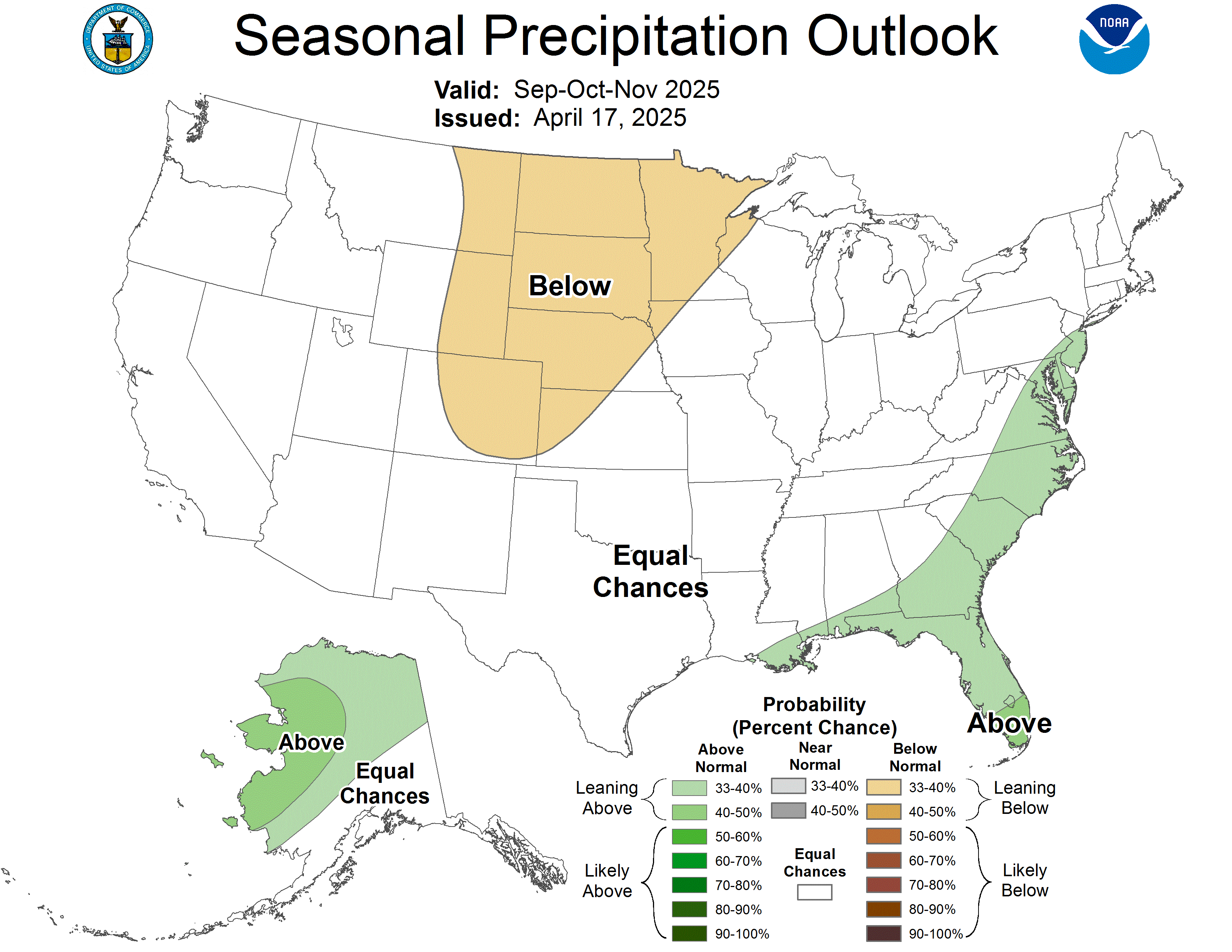
Just looked at the latest climate prediction center maps for this winter and they show the NW is generally above normal or normal temps and below average precipitation. Cali looks like what we had last year with below normal temps and above normal precipitation. We all know its impossible to predict anything that far out but it sure makes you feel better when they are hyping up the cold wet winter over the warm dry!